Shrīgonda geodata
Shrīgonda (Maharashtra) is a populated place; located in India in Asia/Kolkata (GMT+5.5) time zone. With population of 28,208 people, there are 1529 cities with bigger population in this country. Compared to other cities in India, 70% of cities are located further ↑North; 85.4% of cities are located further →East and 85.6% of cities have lower elevation than Shrīgonda. Note1


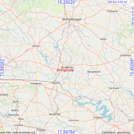
Shrīgonda GPS coordinates[2]
18° 36' 54.972" North, 74° 41' 56.22" East
| Map corner | latitude | longitude |
|---|---|---|
| Upper-left | 19.28029°, | 73.99583° |
| Center: | 18.61527°, | 74.69895° |
| Lower-right: | 17.94764°, | 75.40208° |
| Map W x H: | 148.2×148.2 km | = 92.1×92.1mi |
| max Lat: | 34.9274° ⇑70% North |
| Shrīgonda: | 18.61527° |
| min Lat: | ⇓30% South 8.09008° |
| min Long | Shrīgonda | max Long |
| 68.82655° | 74.69895° | 96.81° |
| W 14.6%⇐ | ⇒85.4% E |
Elevation
Elevation of Shrīgonda is 558 m = 1831 ft, and this is 262.4 m = 861 ft above average elevation for this country.
| Max E: |
3681 m = 12077 ft | 14.4% |
| Shrīgonda | 558 m 1831 ft | |
| Avg. | 295.6 m = 970 ft | |
Min E: |
1 m = 3 ft | 85.6% |
See also: India elevation on elevation.city.
Geographical zone
Shrīgonda is located in North Torrid zone (between Equator and Tropic of Cancer). Distance of this Northern Tropic circle is 536.1 km =333.1 mi to North.| Distance of | km | miles | from Shrīgonda |
|---|---|---|---|
| North Pole | 7937.2 | 4931.9 | to North |
| Arctic Circle | 5331.4 | 3312.8 | to North |
| Tropic Cancer | 536.1 | 333.1 | to North |
| Equator | 2069.8 | 1286.1 | to South |


Nearby cities:
15 places around Shrīgonda: (largest is in red/bold)
• Ahmadnagar
53.5 km =33.2 mi,  4°
4°
• Alandi
84.6 km =52.6 mi,  274°
274°
• Bhigvan
35.7 km =22.2 mi,  168°
168°
• Bārāmati
53.1 km =33 mi,  193°
193°
• Daund
20.6 km =12.8 mi,  216°
216°
• Jejūri
68.2 km =42.4 mi,  236°
236°
• Kalas
50.2 km =31.2 mi, 168°
• Karmāla
57.1 km =35.5 mi,  113°
113°
• Koregaon
67.5 km =41.9 mi, 272°
• Lohogaon
81.4 km =50.6 mi, 268°
• Phaltan
74.9 km =46.5 mi,  202°
202°
• Pāthardi
79.6 km =49.5 mi,  38°
38°
• Sirūr
41.5 km =25.8 mi,  304°
304°
• Sāsvad
76.6 km =47.6 mi,  246°
246°
• Ārangaon
45.8 km =28.5 mi, 2°
Sources, notices
• [Note1] Compared only with cities in India existing in our database
• [Src1] Map data: © OpenStreetMap contributors (CC-BY-SA)
• [Src2] Other city data from geonames.org with taken over terms of usage.
• [Src3] Geographical zone / Annual Mean Temperature by Robert A. Rohde @ Wikipedia
