Khargupur geodata
Khargupur (Uttar Pradesh) is a populated place; located in India in Asia/Kolkata (GMT+5.5) time zone. With population of 9,576 people, there are 2987 cities with bigger population in this country. Compared to other cities in India, 81.1% of cities are located further ↓South; 76.6% of cities are located further ←West and 65.4% of cities have higher elevation than Khargupur. Note1


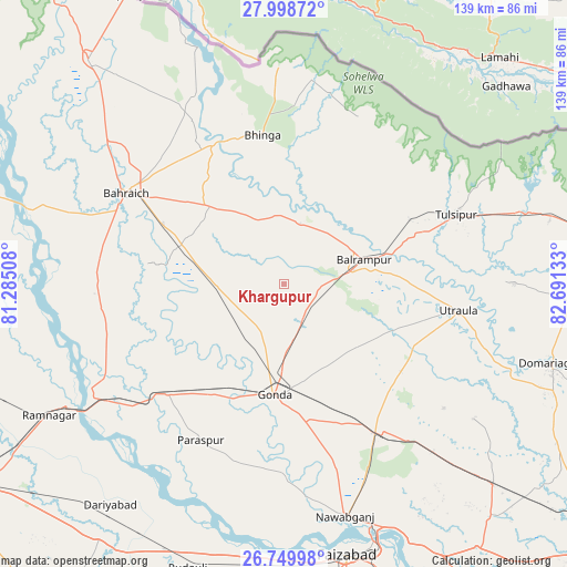
Khargupur GPS coordinates[2]
27° 22' 33.996" North, 81° 59' 17.52" East
| Map corner | latitude | longitude |
|---|---|---|
| Upper-left | 27.99872°, | 81.28508° |
| Center: | 27.37611°, | 81.9882° |
| Lower-right: | 26.74998°, | 82.69133° |
| Map W x H: | 138.8×138.8 km | = 86.2×86.2mi |
| max Lat: | 34.9274° ⇑18.9% North |
| Khargupur: | 27.37611° |
| min Lat: | ⇓81.1% South 8.09008° |
| min Long | Khargupur | max Long |
| 68.82655° | 81.9882° | 96.81° |
| W 76.6%⇐ | ⇒23.4% E |
Elevation
Elevation of Khargupur is 117 m = 384 ft, and this is 178.6 m = 586 ft below average elevation for this country.
| Max E: |
3681 m = 12077 ft | 65.4% |
| Avg. | 295.6 m = 970 ft | |
| Khargupur | 117 m = 384 ft | |
Min E: |
1 m = 3 ft | 34.6% |
See also: India elevation on elevation.city.
Geographical zone
Khargupur is located in North temperate zone (between Tropic of Cancer and the Arctic Circle). Distance of this Northern Tropic circle is 438 km =272.2 mi to South.| Distance of | km | miles | from Khargupur |
|---|---|---|---|
| North Pole | 6963.1 | 4326.7 | to North |
| Arctic Circle | 4357.2 | 2707.4 | to North |
| Tropic Cancer | 438 | 272.2 | to South |
| Equator | 3043.9 | 1891.4 | to South |


Nearby cities:
15 places around Khargupur: (largest is in red/bold)
• Bahraigh
44.6 km =27.7 mi,  299°
299°
• Balrāmpur
20.4 km =12.7 mi,  73°
73°
• Bhinga
36.7 km =22.8 mi,  351°
351°
• Colonelganj
39.3 km =24.4 mi,  226°
226°
• Gondā City
27.4 km =17 mi,  187°
187°
• Ikauna
17.3 km =10.7 mi, 353°
• Jarwal
50.1 km =31.1 mi,  241°
241°
• Katra
15.2 km =9.4 mi,  14°
14°
• Mankāpur
43.2 km =26.8 mi,  146°
146°
• Nawābganj
58.9 km =36.6 mi,  165°
165°
• Pachperwa
66.4 km =41.3 mi,  76°
76°
• Rāmnagar
66.1 km =41.1 mi, 240°
• Tikaitnagar
63.5 km =39.5 mi,  221°
221°
• Tulsīpur
45.8 km =28.5 mi, 67°
• Utraula
43 km =26.7 mi,  98°
98°
Sources, notices
• [Note1] Compared only with cities in India existing in our database
• [Src1] Map data: © OpenStreetMap contributors (CC-BY-SA)
• [Src2] Other city data from geonames.org with taken over terms of usage.
• [Src3] Geographical zone / Annual Mean Temperature by Robert A. Rohde @ Wikipedia
