Tulsīpur geodata
Tulsīpur (Uttar Pradesh) is a populated place; located in India in Asia/Kolkata (GMT+5.5) time zone. With population of 22,486 people, there are 1878 cities with bigger population in this country. Compared to other cities in India, 82.1% of cities are located further ↓South; 77.7% of cities are located further ←West and 65.8% of cities have higher elevation than Tulsīpur. Note1


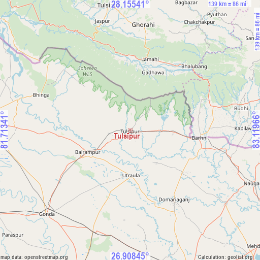
Tulsīpur GPS coordinates[2]
27° 32' 1.32" North, 82° 24' 59.508" East
| Map corner | latitude | longitude |
|---|---|---|
| Upper-left | 28.15541°, | 81.71341° |
| Center: | 27.5337°, | 82.41653° |
| Lower-right: | 26.90845°, | 83.11966° |
| Map W x H: | 138.6×138.7 km | = 86.1×86.2mi |
| max Lat: | 34.9274° ⇑17.9% North |
| Tulsīpur: | 27.5337° |
| min Lat: | ⇓82.1% South 8.09008° |
| min Long | Tulsīpur | max Long |
| 68.82655° | 82.41653° | 96.81° |
| W 77.7%⇐ | ⇒22.3% E |
Elevation
Elevation of Tulsīpur is 115 m = 377 ft, and this is 180.6 m = 593 ft below average elevation for this country.
| Max E: |
3681 m = 12077 ft | 65.8% |
| Avg. | 295.6 m = 970 ft | |
| Tulsīpur | 115 m = 377 ft | |
Min E: |
1 m = 3 ft | 34.2% |
See also: India elevation on elevation.city.
Geographical zone
Tulsīpur is located in North temperate zone (between Tropic of Cancer and the Arctic Circle). Distance of this Northern Tropic circle is 455.5 km =283 mi to South.| Distance of | km | miles | from Tulsīpur |
|---|---|---|---|
| North Pole | 6945.6 | 4315.8 | to North |
| Arctic Circle | 4339.7 | 2696.6 | to North |
| Tropic Cancer | 455.5 | 283 | to South |
| Equator | 3061.5 | 1902.3 | to South |


Nearby cities:
15 places around Tulsīpur: (largest is in red/bold)
• Ajodhya
84.3 km =52.4 mi,  194°
194°
• Bahraigh
81.1 km =50.4 mi,  273°
273°
• Balrāmpur
25.6 km =15.9 mi,  243°
243°
• Bhinga
51.1 km =31.8 mi,  291°
291°
• Bānsi
64.7 km =40.2 mi,  127°
127°
• Colonelganj
83.7 km =52 mi, 237°
• Gondā City
64 km =39.8 mi,  225°
225°
• Haraiya
82.3 km =51.1 mi,  176°
176°
• Ikauna
44.1 km =27.4 mi, 269°
• Katra
38.6 km =24 mi, 265°
• Khargupur
45.8 km =28.5 mi,  247°
247°
• Mankāpur
56.7 km =35.2 mi,  199°
199°
• Nawābganj
79.3 km =49.3 mi, 200°
• Pachperwa
22.5 km =14 mi,  96°
96°
• Utraula
23.8 km =14.8 mi, 179°
Sources, notices
• [Note1] Compared only with cities in India existing in our database
• [Src1] Map data: © OpenStreetMap contributors (CC-BY-SA)
• [Src2] Other city data from geonames.org with taken over terms of usage.
• [Src3] Geographical zone / Annual Mean Temperature by Robert A. Rohde @ Wikipedia
