Ikauna geodata
Ikauna (Uttar Pradesh) is a populated place; located in India in Asia/Kolkata (GMT+5.5) time zone. With population of 14,217 people, there are 2537 cities with bigger population in this country. Compared to other cities in India, 82.1% of cities are located further ↓South; 76.5% of cities are located further ←West and 65.3% of cities have higher elevation than Ikauna. Note1


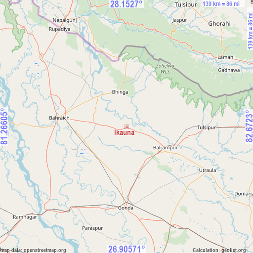
Ikauna GPS coordinates[2]
27° 31' 51.492" North, 81° 58' 9.012" East
| Map corner | latitude | longitude |
|---|---|---|
| Upper-left | 28.1527°, | 81.26605° |
| Center: | 27.53097°, | 81.96917° |
| Lower-right: | 26.90571°, | 82.6723° |
| Map W x H: | 138.7×138.7 km | = 86.2×86.2mi |
| max Lat: | 34.9274° ⇑17.9% North |
| Ikauna: | 27.53097° |
| min Lat: | ⇓82.1% South 8.09008° |
| min Long | Ikauna | max Long |
| 68.82655° | 81.96917° | 96.81° |
| W 76.5%⇐ | ⇒23.5% E |
Elevation
Elevation of Ikauna is 118 m = 387 ft, and this is 177.6 m = 583 ft below average elevation for this country.
| Max E: |
3681 m = 12077 ft | 65.3% |
| Avg. | 295.6 m = 970 ft | |
| Ikauna | 118 m = 387 ft | |
Min E: |
1 m = 3 ft | 34.7% |
See also: India elevation on elevation.city.
Geographical zone
Ikauna is located in North temperate zone (between Tropic of Cancer and the Arctic Circle). Distance of this Northern Tropic circle is 455.2 km =282.8 mi to South.| Distance of | km | miles | from Ikauna |
|---|---|---|---|
| North Pole | 6945.9 | 4316 | to North |
| Arctic Circle | 4340 | 2696.8 | to North |
| Tropic Cancer | 455.2 | 282.8 | to South |
| Equator | 3061.2 | 1902.1 | to South |


Nearby cities:
15 places around Ikauna: (largest is in red/bold)
• Bahraigh
37.2 km =23.1 mi,  277°
277°
• Balrāmpur
24.1 km =15 mi,  117°
117°
• Bhinga
19.4 km =12.1 mi,  349°
349°
• Colonelganj
51.6 km =32.1 mi,  211°
211°
• Gondā City
44.4 km =27.6 mi,  182°
182°
• Jarwal
58.8 km =36.5 mi,  225°
225°
• Katra
6.2 km =3.9 mi,  113°
113°
• Khargupur
17.3 km =10.7 mi,  173°
173°
• Mankāpur
59.2 km =36.8 mi,  154°
154°
• Nawābganj
76.1 km =47.3 mi, 167°
• Nānpāra
59.2 km =36.8 mi,  308°
308°
• Pachperwa
66.5 km =41.3 mi,  91°
91°
• Rāmnagar
74.5 km =46.3 mi, 228°
• Tulsīpur
44.1 km =27.4 mi, 89°
• Utraula
50.2 km =31.2 mi, 117°
Sources, notices
• [Note1] Compared only with cities in India existing in our database
• [Src1] Map data: © OpenStreetMap contributors (CC-BY-SA)
• [Src2] Other city data from geonames.org with taken over terms of usage.
• [Src3] Geographical zone / Annual Mean Temperature by Robert A. Rohde @ Wikipedia
