Katra geodata
Katra (Uttar Pradesh) is a populated place; located in India in Asia/Kolkata (GMT+5.5) time zone. With population of 6,853 people, there are 3225 cities with bigger population in this country. Compared to other cities in India, 81.9% of cities are located further ↓South; 76.7% of cities are located further ←West and 65.8% of cities have higher elevation than Katra. Note1


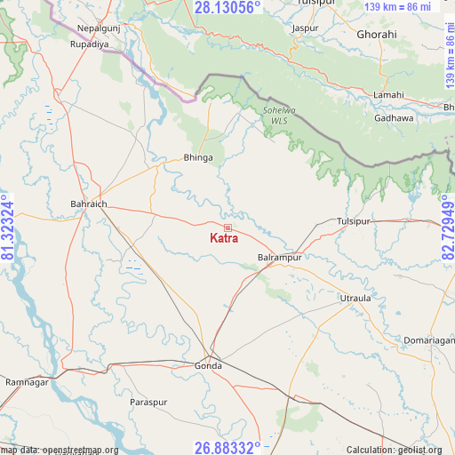
Katra GPS coordinates[2]
27° 30' 31.356" North, 82° 1' 34.896" East
| Map corner | latitude | longitude |
|---|---|---|
| Upper-left | 28.13056°, | 81.32324° |
| Center: | 27.50871°, | 82.02636° |
| Lower-right: | 26.88332°, | 82.72949° |
| Map W x H: | 138.7×138.7 km | = 86.2×86.2mi |
| max Lat: | 34.9274° ⇑18.1% North |
| Katra: | 27.50871° |
| min Lat: | ⇓81.9% South 8.09008° |
| min Long | Katra | max Long |
| 68.82655° | 82.02636° | 96.81° |
| W 76.7%⇐ | ⇒23.3% E |
Elevation
Elevation of Katra is 115 m = 377 ft, and this is 180.6 m = 593 ft below average elevation for this country.
| Max E: |
3681 m = 12077 ft | 65.8% |
| Avg. | 295.6 m = 970 ft | |
| Katra | 115 m = 377 ft | |
Min E: |
1 m = 3 ft | 34.2% |
See also: India elevation on elevation.city.
Geographical zone
Katra is located in North temperate zone (between Tropic of Cancer and the Arctic Circle). Distance of this Northern Tropic circle is 452.8 km =281.4 mi to South.| Distance of | km | miles | from Katra |
|---|---|---|---|
| North Pole | 6948.4 | 4317.5 | to North |
| Arctic Circle | 4342.5 | 2698.3 | to North |
| Tropic Cancer | 452.8 | 281.4 | to South |
| Equator | 3058.7 | 1900.6 | to South |


Nearby cities:
15 places around Katra: (largest is in red/bold)
• Bahraigh
43.2 km =26.8 mi,  279°
279°
• Balrāmpur
18 km =11.2 mi,  119°
119°
• Bhinga
23.4 km =14.5 mi,  337°
337°
• Colonelganj
52.7 km =32.7 mi,  217°
217°
• Gondā City
42.5 km =26.4 mi,  189°
189°
• Ikauna
6.2 km =3.9 mi,  293°
293°
• Jarwal
61.4 km =38.2 mi,  231°
231°
• Khargupur
15.2 km =9.4 mi, 194°
• Mankāpur
54.6 km =33.9 mi,  158°
158°
• Nawābganj
72.6 km =45.1 mi,  171°
171°
• Nānpāra
65.2 km =40.5 mi,  307°
307°
• Pachperwa
60.8 km =37.8 mi,  89°
89°
• Rāmnagar
77.3 km =48 mi, 232°
• Tulsīpur
38.6 km =24 mi, 85°
• Utraula
44.1 km =27.4 mi, 118°
Sources, notices
• [Note1] Compared only with cities in India existing in our database
• [Src1] Map data: © OpenStreetMap contributors (CC-BY-SA)
• [Src2] Other city data from geonames.org with taken over terms of usage.
• [Src3] Geographical zone / Annual Mean Temperature by Robert A. Rohde @ Wikipedia
