Balrāmpur geodata
Balrāmpur (Uttar Pradesh) is a populated place; located in India in Asia/Kolkata (GMT+5.5) time zone. With population of 77,396 people, there are 564 cities with bigger population in this country. Compared to other cities in India, 81.4% of cities are located further ↓South; 77.2% of cities are located further ←West and 66.2% of cities have higher elevation than Balrāmpur. Note1


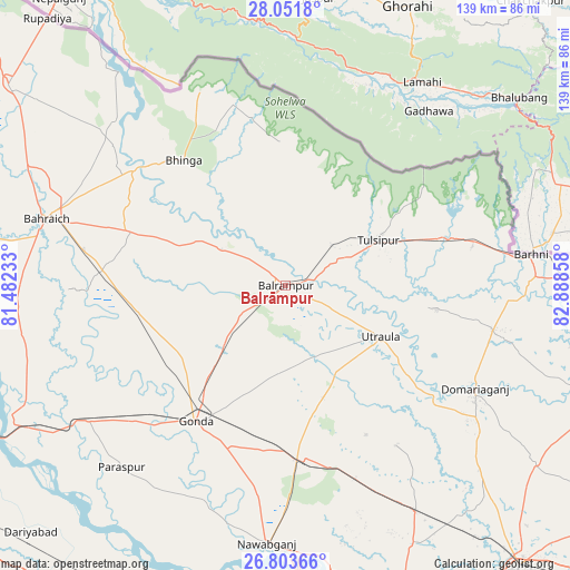
Balrāmpur GPS coordinates[2]
27° 25' 46.164" North, 82° 11' 7.62" East
| Map corner | latitude | longitude |
|---|---|---|
| Upper-left | 28.0518°, | 81.48233° |
| Center: | 27.42949°, | 82.18545° |
| Lower-right: | 26.80366°, | 82.88858° |
| Map W x H: | 138.8×138.8 km | = 86.2×86.2mi |
| max Lat: | 34.9274° ⇑18.6% North |
| Balrāmpur: | 27.42949° |
| min Lat: | ⇓81.4% South 8.09008° |
| min Long | Balrāmpur | max Long |
| 68.82655° | 82.18545° | 96.81° |
| W 77.2%⇐ | ⇒22.8% E |
Elevation
Elevation of Balrāmpur is 112 m = 367 ft, and this is 183.6 m = 602 ft below average elevation for this country.
| Max E: |
3681 m = 12077 ft | 66.2% |
| Avg. | 295.6 m = 970 ft | |
| Balrāmpur | 112 m = 367 ft | |
Min E: |
1 m = 3 ft | 33.8% |
See also: Balrāmpur elevation on elevation.city.
Geographical zone
Balrāmpur is located in North temperate zone (between Tropic of Cancer and the Arctic Circle). Distance of this Northern Tropic circle is 444 km =275.9 mi to South.| Distance of | km | miles | from Balrāmpur |
|---|---|---|---|
| North Pole | 6957.2 | 4323 | to North |
| Arctic Circle | 4351.3 | 2703.8 | to North |
| Tropic Cancer | 444 | 275.9 | to South |
| Equator | 3049.9 | 1895.1 | to South |


Nearby cities:
15 places around Balrāmpur: (largest is in red/bold)
• Ajodhya
70.1 km =43.6 mi,  178°
178°
• Bahraigh
60.4 km =37.5 mi,  285°
285°
• Bhinga
39.2 km =24.4 mi,  320°
320°
• Colonelganj
58.2 km =36.2 mi,  235°
235°
• Fyzābād
72.8 km =45.2 mi, 182°
• Gondā City
40.3 km =25 mi,  214°
214°
• Ikauna
24.1 km =15 mi,  297°
297°
• Jarwal
70.2 km =43.6 mi,  245°
245°
• Katra
18 km =11.2 mi, 299°
• Khargupur
20.4 km =12.7 mi, 253°
• Mankāpur
42.2 km =26.2 mi,  174°
174°
• Nawābganj
63 km =39.1 mi, 183°
• Pachperwa
46.1 km =28.6 mi,  78°
78°
• Tulsīpur
25.6 km =15.9 mi,  63°
63°
• Utraula
26.1 km =16.2 mi,  118°
118°
Sources, notices
• [Note1] Compared only with cities in India existing in our database
• [Src1] Map data: © OpenStreetMap contributors (CC-BY-SA)
• [Src2] Other city data from geonames.org with taken over terms of usage.
• [Src3] Geographical zone / Annual Mean Temperature by Robert A. Rohde @ Wikipedia
