Zābol geodata
Zābol (Sistan and Baluchestan) is a seat of a second-order administrative division; located in Iran in Asia/Tehran (GMT+3.5) time zone. With population of 121,989 people, there are 60 cities with bigger population in this country. Compared to other cities in Iran, 76% of cities are located further ↑North; 99.1% of cities are located further ←West and 73.9% of cities have higher elevation than Zābol. Note1


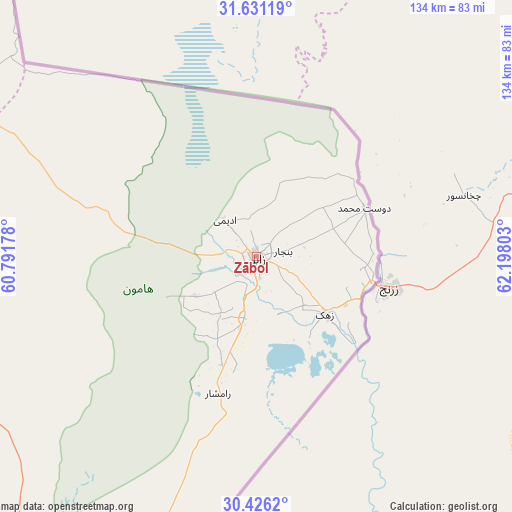
Zābol GPS coordinates[2]
31° 1' 50.16" North, 61° 29' 41.64" East
| Map corner | latitude | longitude |
|---|---|---|
| Upper-left | 31.63119°, | 60.79178° |
| Center: | 31.0306°, | 61.4949° |
| Lower-right: | 30.4262°, | 62.19803° |
| Map W x H: | 134×134 km | = 83.3×83.3mi |
| max Lat: | 39.6482° ⇑76% North |
| Zābol: | 31.0306° |
| min Lat: | ⇓24% South 25.2919° |
| min Long | Zābol | max Long |
| 44.38416° | 61.4949° | 61.9965° |
| W 99.1%⇐ | ⇒0.90000000000001% E |
Elevation
Elevation of Zābol is 483 m = 1585 ft, and this is 566 m = 1857 ft below average elevation for this country.
| Max E: |
2564 m = 8412 ft | 73.9% |
| Avg. | 1049 m = 3442 ft | |
| Zābol | 483 m = 1585 ft | |
Min E: |
-24 m = -79 ft | 26.1% |
See also: Zābol elevation on elevation.city.
Geographical zone
Zābol is located in North temperate zone (between Tropic of Cancer and the Arctic Circle). Distance of this Northern Tropic circle is 844.4 km =524.7 mi to South.| Distance of | km | miles | from Zābol |
|---|---|---|---|
| North Pole | 6556.8 | 4074.2 | to North |
| Arctic Circle | 3950.9 | 2455 | to North |
| Tropic Cancer | 844.4 | 524.7 | to South |
| Equator | 3450.3 | 2143.9 | to South |


Nearby cities:
15 places around Zābol: (largest is in red/bold)
• Asadīyeh
270.6 km =168.1 mi,  321°
321°
• Bam
370.1 km =230 mi,  234°
234°
• Bīrjand
296.1 km =184 mi,  313°
313°
• Dūst Moḩammad Khān
31 km =19.3 mi,  65°
65°
• Fahraj
341.6 km =212.3 mi, 227°
• Khāsh
313.6 km =194.9 mi,  184°
184°
• Moḩammadābād
351.4 km =218.3 mi,  221°
221°
• Narmāshīr
354.9 km =220.5 mi, 229°
• Nehbandān
149.8 km =93.1 mi,  292°
292°
• Noşratābād
191.8 km =119.2 mi, 229°
• Qā’en
370 km =229.9 mi, 324°
• Sarbīsheh
235 km =146 mi, 316°
• Zahedan
181.1 km =112.5 mi,  199°
199°
• Zehak
23.3 km =14.5 mi,  130°
130°
• Ḩājjīābād
319.1 km =198.3 mi,  333°
333°
Sources, notices
• [Note1] Compared only with cities in Iran existing in our database
• [Src1] Map data: © OpenStreetMap contributors (CC-BY-SA)
• [Src2] Other city data from geonames.org with taken over terms of usage.
• [Src3] Geographical zone / Annual Mean Temperature by Robert A. Rohde @ Wikipedia
