Zehak geodata
Zehak (Sistan and Baluchestan) is a seat of a second-order administrative division; located in Iran in Asia/Tehran (GMT+3.5) time zone. In our database, there are 232 cities with bigger population. Compared to other cities in Iran, 76.6% of cities are located further ↑North; 99.5% of cities are located further ←West and 73.2% of cities have higher elevation than Zehak. Note1


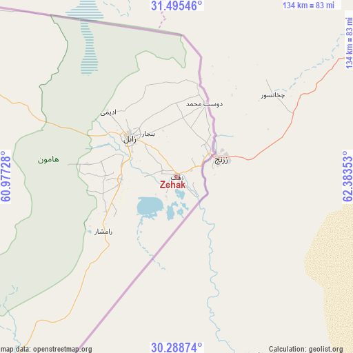
Zehak GPS coordinates[2]
30° 53' 38.4" North, 61° 40' 49.44" East
| Map corner | latitude | longitude |
|---|---|---|
| Upper-left | 31.49546°, | 60.97728° |
| Center: | 30.894°, | 61.6804° |
| Lower-right: | 30.28874°, | 62.38353° |
| Map W x H: | 134.2×134.2 km | = 83.4×83.4mi |
| max Lat: | 39.6482° ⇑76.6% North |
| Zehak: | 30.894° |
| min Lat: | ⇓23.4% South 25.2919° |
| min Long | Zehak | max Long |
| 44.38416° | 61.6804° | 61.9965° |
| W 99.5%⇐ | ⇒0.5% E |
Elevation
Elevation of Zehak is 496 m = 1627 ft, and this is 553 m = 1814 ft below average elevation for this country.
| Max E: |
2564 m = 8412 ft | 73.2% |
| Avg. | 1049 m = 3442 ft | |
| Zehak | 496 m = 1627 ft | |
Min E: |
-24 m = -79 ft | 26.8% |
See also: Iran elevation on elevation.city.
Geographical zone
Zehak is located in North temperate zone (between Tropic of Cancer and the Arctic Circle). Distance of this Northern Tropic circle is 829.2 km =515.2 mi to South.| Distance of | km | miles | from Zehak |
|---|---|---|---|
| North Pole | 6572 | 4083.7 | to North |
| Arctic Circle | 3966.1 | 2464.4 | to North |
| Tropic Cancer | 829.2 | 515.2 | to South |
| Equator | 3435.1 | 2134.5 | to South |


Nearby cities:
15 places around Zehak: (largest is in red/bold)
• Asadīyeh
293.5 km =182.4 mi,  320°
320°
• Bam
376.7 km =234.1 mi,  238°
238°
• Bīrjand
319.4 km =198.5 mi,  313°
313°
• Dūst Moḩammad Khān
29.9 km =18.6 mi,  20°
20°
• Fahraj
345.3 km =214.6 mi,  231°
231°
• Khāsh
300.6 km =186.8 mi,  188°
188°
• Moḩammadābād
352.8 km =219.2 mi, 225°
• Narmāshīr
359.5 km =223.4 mi, 233°
• Nehbandān
172.1 km =106.9 mi,  294°
294°
• Noşratābād
196.7 km =122.2 mi, 235°
• Qā’en
392.7 km =244 mi, 323°
• Sarbīsheh
258.1 km =160.4 mi, 316°
• Zahedan
174.1 km =108.2 mi,  206°
206°
• Zābol
23.3 km =14.5 mi, 310°
• Ḩājjīābād
340.6 km =211.6 mi,  332°
332°
Sources, notices
• [Note1] Compared only with cities in Iran existing in our database
• [Src1] Map data: © OpenStreetMap contributors (CC-BY-SA)
• [Src2] Other city data from geonames.org with taken over terms of usage.
• [Src3] Geographical zone / Annual Mean Temperature by Robert A. Rohde @ Wikipedia
