Fannūj geodata
Fannūj (Sistan and Baluchestan) is a populated place; located in Iran in Asia/Tehran (GMT+3.5) time zone. With population of 13,000 people, there are 204 cities with bigger population in this country. Compared to other cities in Iran, 98% of cities are located further ↑North; 94.3% of cities are located further ←West and 68.9% of cities have higher elevation than Fannūj. Note1


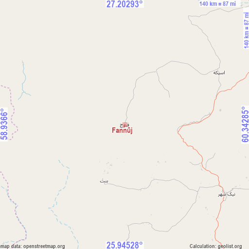
Fannūj GPS coordinates[2]
26° 34' 32.988" North, 59° 38' 22.992" East
| Map corner | latitude | longitude |
|---|---|---|
| Upper-left | 27.20293°, | 58.9366° |
| Center: | 26.57583°, | 59.63972° |
| Lower-right: | 25.94528°, | 60.34285° |
| Map W x H: | 139.8×139.8 km | = 86.9×86.9mi |
| max Lat: | 39.6482° ⇑98% North |
| Fannūj: | 26.57583° |
| min Lat: | ⇓2% South 25.2919° |
| min Long | Fannūj | max Long |
| 44.38416° | 59.63972° | 61.9965° |
| W 94.3%⇐ | ⇒5.7% E |
Elevation
Elevation of Fannūj is 718 m = 2356 ft, and this is 331 m = 1086 ft below average elevation for this country.
| Max E: |
2564 m = 8412 ft | 68.9% |
| Avg. | 1049 m = 3442 ft | |
| Fannūj | 718 m = 2356 ft | |
Min E: |
-24 m = -79 ft | 31.1% |
See also: Iran elevation on elevation.city.
Geographical zone
Fannūj is located in North temperate zone (between Tropic of Cancer and the Arctic Circle). Distance of this Northern Tropic circle is 349 km =216.9 mi to South.| Distance of | km | miles | from Fannūj |
|---|---|---|---|
| North Pole | 7052.1 | 4382 | to North |
| Arctic Circle | 4446.2 | 2762.7 | to North |
| Tropic Cancer | 349 | 216.9 | to South |
| Equator | 2955 | 1836.2 | to South |


Nearby cities:
15 places around Fannūj: (largest is in red/bold)
• Chabahar
174.5 km =108.4 mi,  144°
144°
• Dalgān
102.6 km =63.8 mi,  349°
349°
• Eslāmābād
228.6 km =142 mi,  314°
314°
• Iranshahr
124.9 km =77.6 mi,  56°
56°
• Jask
212.9 km =132.3 mi,  240°
240°
• Khāsh
240.1 km =149.2 mi,  40°
40°
• Konārak
155 km =96.3 mi,  150°
150°
• Manūjān
231.1 km =143.6 mi,  293°
293°
• Moḩammadābād
239.3 km =148.7 mi, 346°
• Nīkshahr
69.2 km =43 mi,  124°
124°
• Qal‘eh Ganj
203.5 km =126.4 mi,  301°
301°
• Qaşr-e Qand
116.6 km =72.5 mi,  108°
108°
• Rāsak
179.2 km =111.3 mi,  102°
102°
• Sardasht
173.3 km =107.7 mi,  265°
265°
• Zābolī
211.1 km =131.2 mi,  72°
72°
Sources, notices
• [Note1] Compared only with cities in Iran existing in our database
• [Src1] Map data: © OpenStreetMap contributors (CC-BY-SA)
• [Src2] Other city data from geonames.org with taken over terms of usage.
• [Src3] Geographical zone / Annual Mean Temperature by Robert A. Rohde @ Wikipedia
