Iranshahr geodata
Iranshahr (Sistan and Baluchestan) is a seat of a second-order administrative division; located in Iran in Asia/Tehran (GMT+3.5) time zone. With population of 131,232 people, there are 55 cities with bigger population in this country. Compared to other cities in Iran, 96.4% of cities are located further ↑North; 97.5% of cities are located further ←West and 72.1% of cities have higher elevation than Iranshahr. Note1


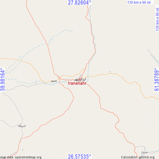
Iranshahr GPS coordinates[2]
27° 12' 8.82" North, 60° 41' 5.136" East
| Map corner | latitude | longitude |
|---|---|---|
| Upper-left | 27.82604°, | 59.98164° |
| Center: | 27.20245°, | 60.68476° |
| Lower-right: | 26.57535°, | 61.38789° |
| Map W x H: | 139.1×139.1 km | = 86.4×86.4mi |
| max Lat: | 39.6482° ⇑96.4% North |
| Iranshahr: | 27.20245° |
| min Lat: | ⇓3.6% South 25.2919° |
| min Long | Iranshahr | max Long |
| 44.38416° | 60.68476° | 61.9965° |
| W 97.5%⇐ | ⇒2.5% E |
Elevation
Elevation of Iranshahr is 566 m = 1857 ft, and this is 483 m = 1585 ft below average elevation for this country.
| Max E: |
2564 m = 8412 ft | 72.1% |
| Avg. | 1049 m = 3442 ft | |
| Iranshahr | 566 m = 1857 ft | |
Min E: |
-24 m = -79 ft | 27.9% |
See also: Iranshahr elevation on elevation.city.
Geographical zone
Iranshahr is located in North temperate zone (between Tropic of Cancer and the Arctic Circle). Distance of this Northern Tropic circle is 418.7 km =260.2 mi to South.| Distance of | km | miles | from Iranshahr |
|---|---|---|---|
| North Pole | 6982.4 | 4338.7 | to North |
| Arctic Circle | 4376.5 | 2719.4 | to North |
| Tropic Cancer | 418.7 | 260.2 | to South |
| Equator | 3024.6 | 1879.4 | to South |


Nearby cities:
15 places around Iranshahr: (largest is in red/bold)
• Chabahar
212.5 km =132 mi,  181°
181°
• Dalgān
126.2 km =78.4 mi,  284°
284°
• Fahraj
262.6 km =163.2 mi,  317°
317°
• Fannūj
124.9 km =77.6 mi,  236°
236°
• Khāsh
124.7 km =77.5 mi,  24°
24°
• Konārak
206.8 km =128.5 mi,  187°
187°
• Moḩammadābād
227.2 km =141.2 mi, 315°
• Narmāshīr
275.4 km =171.1 mi,  314°
314°
• Nīkshahr
118.2 km =73.4 mi,  203°
203°
• Qal‘eh Ganj
279.1 km =173.4 mi, 277°
• Qaşr-e Qand
106.3 km =66.1 mi, 176°
• Rāsak
128.7 km =80 mi,  146°
146°
• Sūrān
130 km =80.8 mi,  85°
85°
• Zahedan
255.6 km =158.8 mi,  3°
3°
• Zābolī
98.2 km =61 mi, 94°
Sources, notices
• [Note1] Compared only with cities in Iran existing in our database
• [Src1] Map data: © OpenStreetMap contributors (CC-BY-SA)
• [Src2] Other city data from geonames.org with taken over terms of usage.
• [Src3] Geographical zone / Annual Mean Temperature by Robert A. Rohde @ Wikipedia
