Rāsak geodata
Rāsak (Sistan and Baluchestan) is a seat of a second-order administrative division; located in Iran in Asia/Tehran (GMT+3.5) time zone. In our database, there are 232 cities with bigger population. Compared to other cities in Iran, 99.1% of cities are located further ↑North; 98.9% of cities are located further ←West and 75.3% of cities have higher elevation than Rāsak. Note1


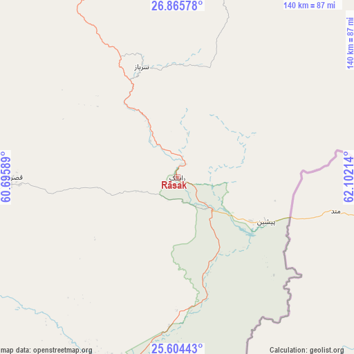
Rāsak GPS coordinates[2]
26° 14' 12.552" North, 61° 23' 56.436" East
| Map corner | latitude | longitude |
|---|---|---|
| Upper-left | 26.86578°, | 60.69589° |
| Center: | 26.23682°, | 61.39901° |
| Lower-right: | 25.60443°, | 62.10214° |
| Map W x H: | 140.2×140.3 km | = 87.1×87.2mi |
| max Lat: | 39.6482° ⇑99.1% North |
| Rāsak: | 26.23682° |
| min Lat: | ⇓0.9% South 25.2919° |
| min Long | Rāsak | max Long |
| 44.38416° | 61.39901° | 61.9965° |
| W 98.9%⇐ | ⇒1.1% E |
Elevation
Elevation of Rāsak is 405 m = 1329 ft, and this is 644 m = 2113 ft below average elevation for this country.
| Max E: |
2564 m = 8412 ft | 75.3% |
| Avg. | 1049 m = 3442 ft | |
| Rāsak | 405 m = 1329 ft | |
Min E: |
-24 m = -79 ft | 24.7% |
See also: Iran elevation on elevation.city.
Geographical zone
Rāsak is located in North temperate zone (between Tropic of Cancer and the Arctic Circle). Distance of this Northern Tropic circle is 311.3 km =193.4 mi to South.| Distance of | km | miles | from Rāsak |
|---|---|---|---|
| North Pole | 7089.8 | 4405.4 | to North |
| Arctic Circle | 4483.9 | 2786.2 | to North |
| Tropic Cancer | 311.3 | 193.4 | to South |
| Equator | 2917.3 | 1812.7 | to South |


Nearby cities:
15 places around Rāsak: (largest is in red/bold)
• Chabahar
129.5 km =80.5 mi,  215°
215°
• Dalgān
238.1 km =147.9 mi,  305°
305°
• Fannūj
179.2 km =111.3 mi,  282°
282°
• Iranshahr
128.7 km =80 mi,  326°
326°
• Jask
368.2 km =228.8 mi,  259°
259°
• Khāsh
221.4 km =137.6 mi,  355°
355°
• Konārak
139.7 km =86.8 mi,  225°
225°
• Moḩammadābād
354.6 km =220.3 mi,  319°
319°
• Nīkshahr
118.2 km =73.4 mi,  269°
269°
• Qal‘eh Ganj
377.1 km =234.3 mi,  292°
292°
• Qaşr-e Qand
64.5 km =40.1 mi, 271°
• Sardasht
349.2 km =217 mi, 273°
• Sūrān
130.8 km =81.3 mi,  26°
26°
• Zahedan
366.2 km =227.5 mi,  351°
351°
• Zābolī
103.1 km =64.1 mi,  15°
15°
Sources, notices
• [Note1] Compared only with cities in Iran existing in our database
• [Src1] Map data: © OpenStreetMap contributors (CC-BY-SA)
• [Src2] Other city data from geonames.org with taken over terms of usage.
• [Src3] Geographical zone / Annual Mean Temperature by Robert A. Rohde @ Wikipedia
