Qaşr-e Qand geodata
Qaşr-e Qand (Sistan and Baluchestan) is a populated place; located in Iran in Asia/Tehran (GMT+3.5) time zone. With population of 37,722 people, there are 157 cities with bigger population in this country. Compared to other cities in Iran, 98.9% of cities are located further ↑North; 97.7% of cities are located further ←West and 72.8% of cities have higher elevation than Qaşr-e Qand. Note1


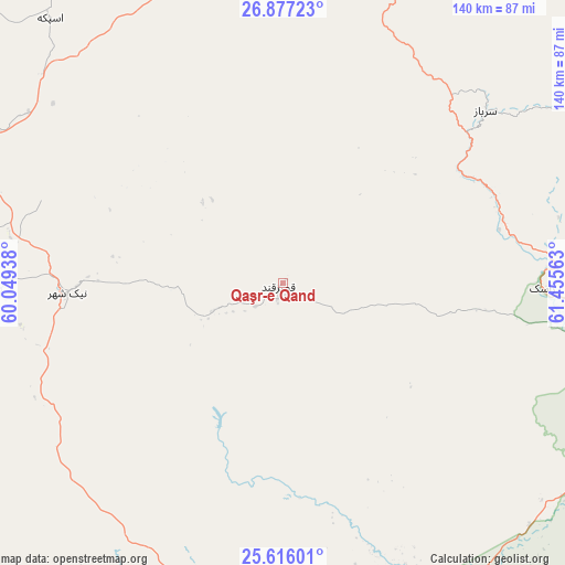
Qaşr-e Qand GPS coordinates[2]
26° 14' 53.988" North, 60° 45' 9" East
| Map corner | latitude | longitude |
|---|---|---|
| Upper-left | 26.87723°, | 60.04938° |
| Center: | 26.24833°, | 60.7525° |
| Lower-right: | 25.61601°, | 61.45563° |
| Map W x H: | 140.2×140.2 km | = 87.1×87.1mi |
| max Lat: | 39.6482° ⇑98.9% North |
| Qaşr-e Qand: | 26.24833° |
| min Lat: | ⇓1.1% South 25.2919° |
| min Long | Qaşr-e Qand | max Long |
| 44.38416° | 60.7525° | 61.9965° |
| W 97.7%⇐ | ⇒2.3% E |
Elevation
Elevation of Qaşr-e Qand is 516 m = 1693 ft, and this is 533 m = 1749 ft below average elevation for this country.
| Max E: |
2564 m = 8412 ft | 72.8% |
| Avg. | 1049 m = 3442 ft | |
| Qaşr-e Qand | 516 m = 1693 ft | |
Min E: |
-24 m = -79 ft | 27.2% |
See also: Iran elevation on elevation.city.
Geographical zone
Qaşr-e Qand is located in North temperate zone (between Tropic of Cancer and the Arctic Circle). Distance of this Northern Tropic circle is 312.6 km =194.2 mi to South.| Distance of | km | miles | from Qaşr-e Qand |
|---|---|---|---|
| North Pole | 7088.5 | 4404.6 | to North |
| Arctic Circle | 4482.6 | 2785.4 | to North |
| Tropic Cancer | 312.6 | 194.2 | to South |
| Equator | 2918.5 | 1813.5 | to South |


Nearby cities:
15 places around Qaşr-e Qand: (largest is in red/bold)
• Chabahar
106.9 km =66.4 mi,  185°
185°
• Dalgān
188.7 km =117.3 mi,  316°
316°
• Eslāmābād
336.5 km =209.1 mi,  305°
305°
• Fannūj
116.6 km =72.5 mi,  288°
288°
• Iranshahr
106.3 km =66.1 mi,  356°
356°
• Jask
305.1 km =189.6 mi,  257°
257°
• Khāsh
224.1 km =139.2 mi,  11°
11°
• Konārak
104.9 km =65.2 mi,  199°
199°
• Moḩammadābād
316 km =196.4 mi,  328°
328°
• Nīkshahr
53.7 km =33.4 mi,  267°
267°
• Qal‘eh Ganj
318.1 km =197.7 mi,  296°
296°
• Rāsak
64.5 km =40.1 mi,  91°
91°
• Sardasht
284.9 km =177 mi, 274°
• Sūrān
169 km =105 mi,  46°
46°
• Zābolī
134.2 km =83.4 mi,  43°
43°
Sources, notices
• [Note1] Compared only with cities in Iran existing in our database
• [Src1] Map data: © OpenStreetMap contributors (CC-BY-SA)
• [Src2] Other city data from geonames.org with taken over terms of usage.
• [Src3] Geographical zone / Annual Mean Temperature by Robert A. Rohde @ Wikipedia
