Zābolī geodata
Zābolī (Sistan and Baluchestan) is a seat of a second-order administrative division; located in Iran in Asia/Tehran (GMT+3.5) time zone. In our database, there are 232 cities with bigger population. Compared to other cities in Iran, 97.3% of cities are located further ↑North; 99.3% of cities are located further ←West and 55.8% of cities have lower elevation than Zābolī. Note1


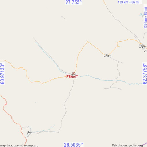
Zābolī GPS coordinates[2]
27° 7' 51.6" North, 61° 40' 28.02" East
| Map corner | latitude | longitude |
|---|---|---|
| Upper-left | 27.755°, | 60.97133° |
| Center: | 27.131°, | 61.67445° |
| Lower-right: | 26.5035°, | 62.37758° |
| Map W x H: | 139.2×139.2 km | = 86.5×86.5mi |
| max Lat: | 39.6482° ⇑97.3% North |
| Zābolī: | 27.131° |
| min Lat: | ⇓2.7% South 25.2919° |
| min Long | Zābolī | max Long |
| 44.38416° | 61.67445° | 61.9965° |
| W 99.3%⇐ | ⇒0.7% E |
Elevation
Elevation of Zābolī is 1274 m = 4180 ft, and this is 225 m = 738 ft above average elevation for this country.
| Max E: |
2564 m = 8412 ft | 44.2% |
| Zābolī | 1274 m 4180 ft | |
| Avg. | 1049 m = 3442 ft | |
Min E: |
-24 m = -79 ft | 55.8% |
See also: Iran elevation on elevation.city.
Geographical zone
Zābolī is located in North temperate zone (between Tropic of Cancer and the Arctic Circle). Distance of this Northern Tropic circle is 410.8 km =255.3 mi to South.| Distance of | km | miles | from Zābolī |
|---|---|---|---|
| North Pole | 6990.4 | 4343.6 | to North |
| Arctic Circle | 4384.5 | 2724.4 | to North |
| Tropic Cancer | 410.8 | 255.3 | to South |
| Equator | 3016.7 | 1874.5 | to South |


Nearby cities:
15 places around Zābolī: (largest is in red/bold)
• Chabahar
228.9 km =142.2 mi,  206°
206°
• Dalgān
223.5 km =138.9 mi,  280°
280°
• Fahraj
340.4 km =211.5 mi,  306°
306°
• Fannūj
211.1 km =131.2 mi,  252°
252°
• Iranshahr
98.2 km =61 mi,  274°
274°
• Khāsh
129.3 km =80.3 mi,  339°
339°
• Konārak
234.4 km =145.6 mi, 212°
• Moḩammadābād
307.5 km =191.1 mi,  303°
303°
• Narmāshīr
355.4 km =220.8 mi, 304°
• Noşratābād
349.4 km =217.1 mi,  331°
331°
• Nīkshahr
176.6 km =109.7 mi,  235°
235°
• Qaşr-e Qand
134.2 km =83.4 mi,  223°
223°
• Rāsak
103.1 km =64.1 mi,  195°
195°
• Sūrān
36.2 km =22.5 mi,  61°
61°
• Zahedan
274.7 km =170.7 mi, 343°
Sources, notices
• [Note1] Compared only with cities in Iran existing in our database
• [Src1] Map data: © OpenStreetMap contributors (CC-BY-SA)
• [Src2] Other city data from geonames.org with taken over terms of usage.
• [Src3] Geographical zone / Annual Mean Temperature by Robert A. Rohde @ Wikipedia
