Sūrān geodata
Sūrān (Sistan and Baluchestan) is a seat of a second-order administrative division; located in Iran in Asia/Tehran (GMT+3.5) time zone. In our database, there are 232 cities with bigger population. Compared to other cities in Iran, 95.9% of cities are located further ↑North; 100% of cities are located further ←West and 51.2% of cities have higher elevation than Sūrān. Note1


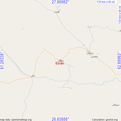
Sūrān GPS coordinates[2]
27° 17' 7.8" North, 61° 59' 47.4" East
| Map corner | latitude | longitude |
|---|---|---|
| Upper-left | 27.90862°, | 61.29338° |
| Center: | 27.2855°, | 61.9965° |
| Lower-right: | 26.65886°, | 62.69963° |
| Map W x H: | 139×139 km | = 86.4×86.4mi |
| max Lat: | 39.6482° ⇑95.9% North |
| Sūrān: | 27.2855° |
| min Lat: | ⇓4.1% South 25.2919° |
| min Long | Sūrān | max Long |
| 44.38416° | 61.9965° | 61.9965° |
| W 100%⇐ | ⇒0% E |
Elevation
Elevation of Sūrān is 1151 m = 3776 ft, and this is 102 m = 335 ft above average elevation for this country.
| Max E: |
2564 m = 8412 ft | 51.2% |
| Sūrān | 1151 m 3776 ft | |
| Avg. | 1049 m = 3442 ft | |
Min E: |
-24 m = -79 ft | 48.8% |
See also: Iran elevation on elevation.city.
Geographical zone
Sūrān is located in North temperate zone (between Tropic of Cancer and the Arctic Circle). Distance of this Northern Tropic circle is 427.9 km =265.9 mi to South.| Distance of | km | miles | from Sūrān |
|---|---|---|---|
| North Pole | 6973.2 | 4332.9 | to North |
| Arctic Circle | 4367.3 | 2713.7 | to North |
| Tropic Cancer | 427.9 | 265.9 | to South |
| Equator | 3033.9 | 1885.2 | to South |


Nearby cities:
15 places around Sūrān: (largest is in red/bold)
• Chabahar
259.5 km =161.2 mi,  211°
211°
• Dalgān
252.7 km =157 mi,  274°
274°
• Fahraj
356.9 km =221.8 mi,  301°
301°
• Fannūj
246.6 km =153.2 mi,  251°
251°
• Iranshahr
130 km =80.8 mi, 265°
• Khāsh
129.3 km =80.3 mi,  323°
323°
• Konārak
266.7 km =165.7 mi,  216°
216°
• Moḩammadābād
325.6 km =202.3 mi, 298°
• Narmāshīr
372.8 km =231.6 mi, 299°
• Noşratābād
350.9 km =218 mi,  325°
325°
• Nīkshahr
212.6 km =132.1 mi,  236°
236°
• Qaşr-e Qand
169 km =105 mi,  226°
226°
• Rāsak
130.8 km =81.3 mi, 206°
• Zahedan
269.7 km =167.6 mi,  335°
335°
• Zābolī
36.2 km =22.5 mi, 241°
Sources, notices
• [Note1] Compared only with cities in Iran existing in our database
• [Src1] Map data: © OpenStreetMap contributors (CC-BY-SA)
• [Src2] Other city data from geonames.org with taken over terms of usage.
• [Src3] Geographical zone / Annual Mean Temperature by Robert A. Rohde @ Wikipedia
