Ak-Suu geodata
Ak-Suu (Issyk-Kul) is a seat of a second-order administrative division; located in Kyrgyzstan in Asia/Bishkek (GMT+6) time zone. With population of 10,823 people, there are 27 cities with bigger population in this country. Compared to other cities in Kyrgyzstan, 78.6% of cities are located further ↓South; 100% of cities are located further ←West and 91.7% of cities have lower elevation than Ak-Suu. Note1


Ak-Suu GPS coordinates[2]
42° 29' 58.128" North, 78° 31' 37.272" East
| Map corner | latitude | longitude |
|---|---|---|
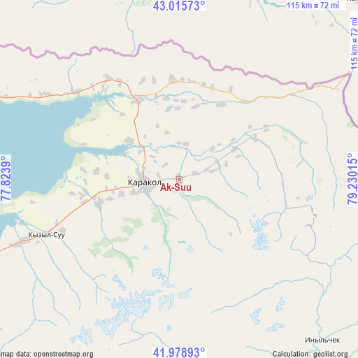
| Upper-left | 43.01573°, | 77.8239° |
| Center: | 42.49948°, | 78.52702° |
| Lower-right: | 41.97893°, | 79.23015° |
| Map W x H: | 115.3×115.3 km | = 71.6×71.6mi |
| max Lat: | 42.89106° ⇑21.4% North |
| Ak-Suu: | 42.49948° |
| min Lat: | ⇓78.6% South 39.55274° |
| min Long | Ak-Suu | max Long |
| 69.3716° | 78.52702° | 78.52702° |
| W 100%⇐ | ⇒0% E |
Elevation
Elevation of Ak-Suu is 1814 m = 5951 ft, and this is 612.6 m = 2010 ft above average elevation for this country.
| Max E: |
2638 m = 8655 ft | 8.3% |
| Ak-Suu | 1814 m 5951 ft | |
| Avg. | 1201.4 m = 3942 ft | |
Min E: |
504 m = 1654 ft | 91.7% |
See also: Kyrgyzstan elevation on elevation.city.
Geographical zone
Ak-Suu is located in North temperate zone (between Tropic of Cancer and the Arctic Circle). Distance of this Northern Tropic circle is 2119.6 km =1317.1 mi to South.| Distance of | km | miles | from Ak-Suu |
|---|---|---|---|
| North Pole | 5281.6 | 3281.8 | to North |
| Arctic Circle | 2675.7 | 1662.6 | to North |
| Tropic Cancer | 2119.6 | 1317.1 | to South |
| Equator | 4725.5 | 2936.3 | to South |


Nearby cities:
15 places around Ak-Suu: (largest is in red/bold)
• At-Bashi
269.9 km =167.7 mi,  236°
236°
• Balykchy
191.9 km =119.2 mi,  268°
268°
• Bokombayevskoye
133.1 km =82.7 mi,  251°
251°
• Cholpon-Ata
119.5 km =74.3 mi,  278°
278°
• Chuy
267.7 km =166.3 mi, 277°
• Ivanovka
284.6 km =176.8 mi, 278°
• Kadzhi-Say
117.8 km =73.2 mi, 250°
• Karakol
11 km =6.8 mi,  264°
264°
• Kemin
234.1 km =145.5 mi, 277°
• Kochkor
229.8 km =142.8 mi, 262°
• Kyzyl-Suu
46.2 km =28.7 mi, 247°
• Naryn
241.1 km =149.8 mi, 240°
• Tokmok
266.4 km =165.5 mi, 278°
• Tossor
96.6 km =60 mi, 247°
• Tyup
28.6 km =17.8 mi,  332°
332°
Sources, notices
• [Note1] Compared only with cities in Kyrgyzstan existing in our database
• [Src1] Map data: © OpenStreetMap contributors (CC-BY-SA)
• [Src2] Other city data from geonames.org with taken over terms of usage.
• [Src3] Geographical zone / Annual Mean Temperature by Robert A. Rohde @ Wikipedia
