Kyzyl-Suu geodata
Kyzyl-Suu (Issyk-Kul) is a seat of a second-order administrative division; located in Kyrgyzstan in Asia/Bishkek (GMT+6) time zone. With population of 16,927 people, there are 19 cities with bigger population in this country. Compared to other cities in Kyrgyzstan, 72.6% of cities are located further ↓South; 96.4% of cities are located further ←West and 88.1% of cities have lower elevation than Kyzyl-Suu. Note1


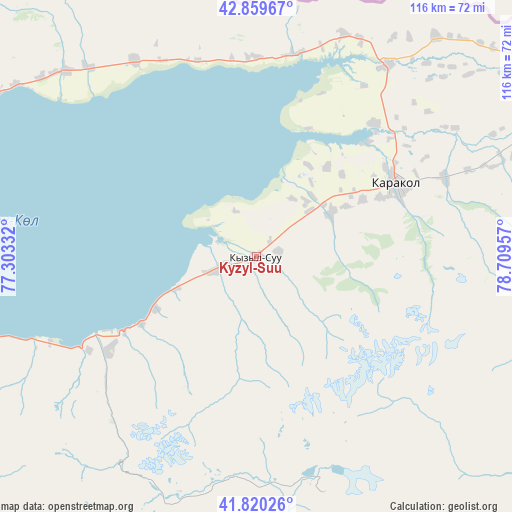
Kyzyl-Suu GPS coordinates[2]
42° 20' 31.596" North, 78° 0' 23.184" East
| Map corner | latitude | longitude |
|---|---|---|
| Upper-left | 42.85967°, | 77.30332° |
| Center: | 42.34211°, | 78.00644° |
| Lower-right: | 41.82026°, | 78.70957° |
| Map W x H: | 115.6×115.6 km | = 71.8×71.8mi |
| max Lat: | 42.89106° ⇑27.4% North |
| Kyzyl-Suu: | 42.34211° |
| min Lat: | ⇓72.6% South 39.55274° |
| min Long | Kyzyl-Suu | max Long |
| 69.3716° | 78.00644° | 78.52702° |
| W 96.4%⇐ | ⇒3.6% E |
Elevation
Elevation of Kyzyl-Suu is 1757 m = 5764 ft, and this is 555.6 m = 1823 ft above average elevation for this country.
| Max E: |
2638 m = 8655 ft | 11.9% |
| Kyzyl-Suu | 1757 m 5764 ft | |
| Avg. | 1201.4 m = 3942 ft | |
Min E: |
504 m = 1654 ft | 88.1% |
See also: Kyrgyzstan elevation on elevation.city.
Geographical zone
Kyzyl-Suu is located in North temperate zone (between Tropic of Cancer and the Arctic Circle). Distance of this Northern Tropic circle is 2102.1 km =1306.2 mi to South.| Distance of | km | miles | from Kyzyl-Suu |
|---|---|---|---|
| North Pole | 5299.1 | 3292.7 | to North |
| Arctic Circle | 2693.2 | 1673.5 | to North |
| Tropic Cancer | 2102.1 | 1306.2 | to South |
| Equator | 4708 | 2925.4 | to South |


Nearby cities:
15 places around Kyzyl-Suu: (largest is in red/bold)
• Ak-Suu
46.2 km =28.7 mi,  67°
67°
• At-Bashi
224.6 km =139.6 mi,  234°
234°
• Balykchy
150 km =93.2 mi,  275°
275°
• Bokombayevskoye
87.1 km =54.1 mi,  253°
253°
• Cholpon-Ata
83.1 km =51.6 mi,  294°
294°
• Chuy
229.3 km =142.5 mi, 283°
• Ivanovka
246.6 km =153.2 mi, 284°
• Kadzhi-Say
71.7 km =44.6 mi, 251°
• Karakol
35.8 km =22.2 mi,  62°
62°
• Kemin
195.9 km =121.7 mi, 284°
• Kochkor
185.6 km =115.3 mi,  265°
265°
• Naryn
195.3 km =121.4 mi,  238°
238°
• Tokmok
228.3 km =141.9 mi, 284°
• Tossor
50.4 km =31.3 mi, 247°
• Tyup
52 km =32.3 mi,  34°
34°
Sources, notices
• [Note1] Compared only with cities in Kyrgyzstan existing in our database
• [Src1] Map data: © OpenStreetMap contributors (CC-BY-SA)
• [Src2] Other city data from geonames.org with taken over terms of usage.
• [Src3] Geographical zone / Annual Mean Temperature by Robert A. Rohde @ Wikipedia
