Zhezqazghan geodata
Zhezqazghan (Karaganda) is a populated place; located in Kazakhstan in Asia/Almaty (GMT+5) time zone. With population of 104,357 people, there are 20 cities with bigger population in this country. Compared to other cities in Kazakhstan, 57.4% of cities are located further ↑North; 65.9% of cities are located further →East and 50.4% of cities have lower elevation than Zhezqazghan. Note1


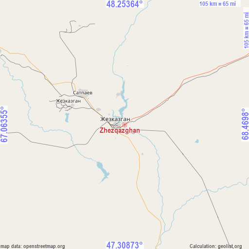
Zhezqazghan GPS coordinates[2]
47° 46' 59.988" North, 67° 46' 0.012" East
| Map corner | latitude | longitude |
|---|---|---|
| Upper-left | 48.25364°, | 67.06355° |
| Center: | 47.78333°, | 67.76667° |
| Lower-right: | 47.30873°, | 68.4698° |
| Map W x H: | 105.1×105.1 km | = 65.3×65.3mi |
| max Lat: | 54.90596° ⇑57.4% North |
| Zhezqazghan: | 47.78333° |
| min Lat: | ⇓42.6% South 40.66338° |
| min Long | Zhezqazghan | max Long |
| 46.83361° | 67.76667° | 84.87144° |
| W 34.1%⇐ | ⇒65.9% E |
Elevation
Elevation of Zhezqazghan is 330 m = 1083 ft, and this is 26.5 m = 87 ft below average elevation for this country.
| Max E: |
1847 m = 6060 ft | 49.6% |
| Avg. | 356.5 m = 1170 ft | |
| Zhezqazghan | 330 m = 1083 ft | |
Min E: |
-26 m = -85 ft | 50.4% |
See also: Zhezqazghan elevation on elevation.city.
Geographical zone
Zhezqazghan is located in North temperate zone (between Tropic of Cancer and the Arctic Circle). Distance of this North polar circle is 2088.2 km =1297.5 mi to North.| Distance of | km | miles | from Zhezqazghan |
|---|---|---|---|
| North Pole | 4694.1 | 2916.8 | to North |
| Arctic Circle | 2088.2 | 1297.5 | to North |
| Tropic Cancer | 2707.1 | 1682.1 | to South |
| Equator | 5313 | 3301.3 | to South |


Nearby cities:
15 places around Zhezqazghan: (largest is in red/bold)
• Arkalyk
281 km =174.6 mi,  347°
347°
• Atasū
304.2 km =189 mi,  70°
70°
• Belköl
370.4 km =230.2 mi,  206°
206°
• Derzhavīnsk
383.3 km =238.2 mi,  344°
344°
• Egindiköl
384.2 km =238.7 mi,  18°
18°
• Kyzylorda
369.1 km =229.3 mi, 208°
• Qarazhal
227.2 km =141.2 mi,  83°
83°
• Shalqīya
420.5 km =261.3 mi,  183°
183°
• Shubarköl
144.4 km =89.7 mi,  32°
32°
• Shyghanaq
370.5 km =230.2 mi,  152°
152°
• Shīeli
409.7 km =254.6 mi,  191°
191°
• Tasböget
375.4 km =233.3 mi, 206°
• Terenozek
371.2 km =230.7 mi,  215°
215°
• Yanykurgan
432.9 km =269 mi, 185°
• Zhambyl
280.1 km =174 mi,  103°
103°
Sources, notices
• [Note1] Compared only with cities in Kazakhstan existing in our database
• [Src1] Map data: © OpenStreetMap contributors (CC-BY-SA)
• [Src2] Other city data from geonames.org with taken over terms of usage.
• [Src3] Geographical zone / Annual Mean Temperature by Robert A. Rohde @ Wikipedia
