Shyghanaq geodata
Shyghanaq (Zhambyl) is a populated place; located in Kazakhstan in Asia/Almaty (GMT+5) time zone. With population of 2,405 people, there are 239 cities with bigger population in this country. Compared to other cities in Kazakhstan, 74.8% of cities are located further ↑North; 51.5% of cities are located further →East and 62.6% of cities have higher elevation than Shyghanaq. Note1


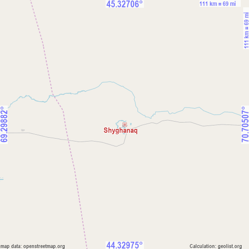
Shyghanaq GPS coordinates[2]
44° 49' 50.016" North, 70° 0' 6.984" East
| Map corner | latitude | longitude |
|---|---|---|
| Upper-left | 45.32706°, | 69.29882° |
| Center: | 44.83056°, | 70.00194° |
| Lower-right: | 44.32975°, | 70.70507° |
| Map W x H: | 110.9×110.9 km | = 68.9×68.9mi |
| max Lat: | 54.90596° ⇑74.8% North |
| Shyghanaq: | 44.83056° |
| min Lat: | ⇓25.2% South 40.66338° |
| min Long | Shyghanaq | max Long |
| 46.83361° | 70.00194° | 84.87144° |
| W 48.5%⇐ | ⇒51.5% E |
Elevation
Elevation of Shyghanaq is 217 m = 712 ft, and this is 139.5 m = 458 ft below average elevation for this country.
| Max E: |
1847 m = 6060 ft | 62.6% |
| Avg. | 356.5 m = 1170 ft | |
| Shyghanaq | 217 m = 712 ft | |
Min E: |
-26 m = -85 ft | 37.4% |
See also: Kazakhstan elevation on elevation.city.
Geographical zone
Shyghanaq is located in North temperate zone (between Tropic of Cancer and the Arctic Circle). Distance of this Northern Tropic circle is 2378.8 km =1478.1 mi to South.| Distance of | km | miles | from Shyghanaq |
|---|---|---|---|
| North Pole | 5022.4 | 3120.8 | to North |
| Arctic Circle | 2416.5 | 1501.5 | to North |
| Tropic Cancer | 2378.8 | 1478.1 | to South |
| Equator | 4984.7 | 3097.3 | to South |


Nearby cities:
15 places around Shyghanaq: (largest is in red/bold)
• Aqbaqay
219.8 km =136.6 mi,  85°
85°
• Ashchysay
167 km =103.8 mi,  211°
211°
• Bayzhansay
185.1 km =115 mi,  182°
182°
• Chayan
205.9 km =127.9 mi,  193°
193°
• Chulakkurgan
135.4 km =84.1 mi, 208°
• Kantagi
183.8 km =114.2 mi,  217°
217°
• Karatau
187.4 km =116.4 mi,  168°
168°
• Kentau
188.7 km =117.3 mi, 219°
• Moyynkum
240.5 km =149.4 mi,  104°
104°
• Sarykemer
236.3 km =146.8 mi,  149°
149°
• Shalqīya
225.1 km =139.9 mi,  246°
246°
• Taraz
240.9 km =149.7 mi, 152°
• Turkestan
220.5 km =137 mi, 219°
• Yanykurgan
241.9 km =150.3 mi,  244°
244°
• Zhangatas
142.6 km =88.6 mi, 188°
Sources, notices
• [Note1] Compared only with cities in Kazakhstan existing in our database
• [Src1] Map data: © OpenStreetMap contributors (CC-BY-SA)
• [Src2] Other city data from geonames.org with taken over terms of usage.
• [Src3] Geographical zone / Annual Mean Temperature by Robert A. Rohde @ Wikipedia
