Derzhavīnsk geodata
Derzhavīnsk (Aqmola) is a populated place; located in Kazakhstan in Asia/Almaty (GMT+5) time zone. With population of 13,856 people, there are 85 cities with bigger population in this country. Compared to other cities in Kazakhstan, 75.2% of cities are located further ↓South; 70.4% of cities are located further →East and 58.9% of cities have higher elevation than Derzhavīnsk. Note1


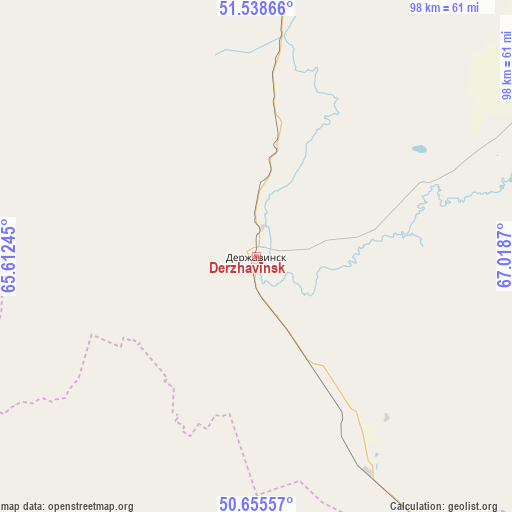
Derzhavīnsk GPS coordinates[2]
51° 5' 57.192" North, 66° 18' 56.052" East
| Map corner | latitude | longitude |
|---|---|---|
| Upper-left | 51.53866°, | 65.61245° |
| Center: | 51.09922°, | 66.31557° |
| Lower-right: | 50.65557°, | 67.0187° |
| Map W x H: | 98.2×98.2 km | = 61×61mi |
| max Lat: | 54.90596° ⇑24.8% North |
| Derzhavīnsk: | 51.09922° |
| min Lat: | ⇓75.2% South 40.66338° |
| min Long | Derzhavīnsk | max Long |
| 46.83361° | 66.31557° | 84.87144° |
| W 29.6%⇐ | ⇒70.4% E |
Elevation
Elevation of Derzhavīnsk is 247 m = 810 ft, and this is 109.5 m = 359 ft below average elevation for this country.
| Max E: |
1847 m = 6060 ft | 58.9% |
| Avg. | 356.5 m = 1170 ft | |
| Derzhavīnsk | 247 m = 810 ft | |
Min E: |
-26 m = -85 ft | 41.1% |
See also: Kazakhstan elevation on elevation.city.
Geographical zone
Derzhavīnsk is located in North temperate zone (between Tropic of Cancer and the Arctic Circle). Distance of this North polar circle is 1719.5 km =1068.4 mi to North.| Distance of | km | miles | from Derzhavīnsk |
|---|---|---|---|
| North Pole | 4325.4 | 2687.7 | to North |
| Arctic Circle | 1719.5 | 1068.4 | to North |
| Tropic Cancer | 3075.8 | 1911.2 | to South |
| Equator | 5681.7 | 3530.4 | to South |


Nearby cities:
15 places around Derzhavīnsk: (largest is in red/bold)
• Arkalyk
103.7 km =64.4 mi,  155°
155°
• Astrakhan
246.6 km =153.2 mi,  78°
78°
• Atbasar
160.1 km =99.5 mi,  60°
60°
• Atbasar
162 km =100.7 mi, 60°
• Balkashino
230 km =142.9 mi,  46°
46°
• Egindiköl
221.1 km =137.4 mi,  91°
91°
• Esil
95.4 km =59.3 mi,  3°
3°
• Karasu
182.7 km =113.5 mi,  341°
341°
• Krasnogorskiy
128.2 km =79.7 mi,  6°
6°
• Novoishimskiy
235.4 km =146.3 mi, 7°
• Qusmuryn
190.3 km =118.2 mi,  322°
322°
• Shantobe
197.6 km =122.8 mi,  40°
40°
• Torghay
257.8 km =160.2 mi,  230°
230°
• Volodarskoye
174.7 km =108.6 mi, 6°
• Zhaqsy
113.7 km =70.6 mi, 37°
Sources, notices
• [Note1] Compared only with cities in Kazakhstan existing in our database
• [Src1] Map data: © OpenStreetMap contributors (CC-BY-SA)
• [Src2] Other city data from geonames.org with taken over terms of usage.
• [Src3] Geographical zone / Annual Mean Temperature by Robert A. Rohde @ Wikipedia
