Torghay geodata
Torghay (Qostanay) is a populated place; located in Kazakhstan in Asia/Qostanay (GMT+5) time zone. With population of 5,277 people, there are 186 cities with bigger population in this country. Compared to other cities in Kazakhstan, 57.8% of cities are located further ↓South; 74.8% of cities are located further →East and 82.6% of cities have higher elevation than Torghay. Note1


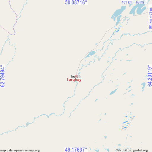
Torghay GPS coordinates[2]
49° 38' 2.004" North, 63° 29' 53.016" East
| Map corner | latitude | longitude |
|---|---|---|
| Upper-left | 50.08716°, | 62.79494° |
| Center: | 49.63389°, | 63.49806° |
| Lower-right: | 49.17637°, | 64.20119° |
| Map W x H: | 101.3×101.3 km | = 62.9×62.9mi |
| max Lat: | 54.90596° ⇑42.2% North |
| Torghay: | 49.63389° |
| min Lat: | ⇓57.8% South 40.66338° |
| min Long | Torghay | max Long |
| 46.83361° | 63.49806° | 84.87144° |
| W 25.2%⇐ | ⇒74.8% E |
Elevation
Elevation of Torghay is 105 m = 344 ft, and this is 251.5 m = 825 ft below average elevation for this country.
| Max E: |
1847 m = 6060 ft | 82.6% |
| Avg. | 356.5 m = 1170 ft | |
| Torghay | 105 m = 344 ft | |
Min E: |
-26 m = -85 ft | 17.4% |
See also: Kazakhstan elevation on elevation.city.
Geographical zone
Torghay is located in North temperate zone (between Tropic of Cancer and the Arctic Circle). Distance of this North polar circle is 1882.4 km =1169.7 mi to North.| Distance of | km | miles | from Torghay |
|---|---|---|---|
| North Pole | 4488.3 | 2788.9 | to North |
| Arctic Circle | 1882.4 | 1169.7 | to North |
| Tropic Cancer | 2912.9 | 1810 | to South |
| Equator | 5518.8 | 3429.2 | to South |


Nearby cities:
15 places around Torghay: (largest is in red/bold)
• Aral
343 km =213.1 mi,  203°
203°
• Arkalyk
254.2 km =158 mi,  74°
74°
• Ayat
362.4 km =225.2 mi,  349°
349°
• Derzhavīnsk
257.8 km =160.2 mi,  50°
50°
• Dzhetygara
326.7 km =203 mi,  330°
330°
• Esil
329.3 km =204.6 mi,  38°
38°
• Karasu
363.8 km =226.1 mi,  22°
22°
• Krasnogorskiy
359.4 km =223.3 mi, 36°
• Lisakovsk
331.3 km =205.9 mi, 347°
• Ordzhonikidze
335.9 km =208.7 mi,  338°
338°
• Qusmuryn
322.9 km =200.6 mi,  14°
14°
• Rudnyy
372.2 km =231.3 mi,  355°
355°
• Sekseūil
331.7 km =206.1 mi,  211°
211°
• Tobol
346 km =215 mi, 349°
• Yrghyz
197.9 km =123 mi,  235°
235°
Sources, notices
• [Note1] Compared only with cities in Kazakhstan existing in our database
• [Src1] Map data: © OpenStreetMap contributors (CC-BY-SA)
• [Src2] Other city data from geonames.org with taken over terms of usage.
• [Src3] Geographical zone / Annual Mean Temperature by Robert A. Rohde @ Wikipedia
