Krasnogorskiy geodata
Krasnogorskiy (Aqmola) is a populated place; located in Kazakhstan in Asia/Almaty (GMT+5) time zone. With population of 3,646 people, there are 219 cities with bigger population in this country. Compared to other cities in Kazakhstan, 83.7% of cities are located further ↓South; 69.3% of cities are located further →East and 65.9% of cities have higher elevation than Krasnogorskiy. Note1


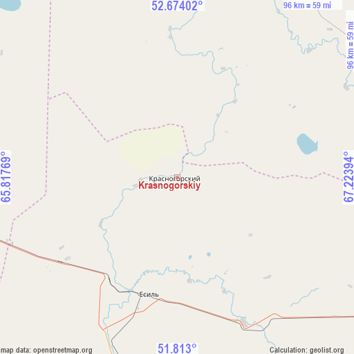
Krasnogorskiy GPS coordinates[2]
52° 14' 44.16" North, 66° 31' 14.916" East
| Map corner | latitude | longitude |
|---|---|---|
| Upper-left | 52.67402°, | 65.81769° |
| Center: | 52.2456°, | 66.52081° |
| Lower-right: | 51.813°, | 67.22394° |
| Map W x H: | 95.7×95.7 km | = 59.5×59.5mi |
| max Lat: | 54.90596° ⇑16.3% North |
| Krasnogorskiy: | 52.2456° |
| min Lat: | ⇓83.7% South 40.66338° |
| min Long | Krasnogorskiy | max Long |
| 46.83361° | 66.52081° | 84.87144° |
| W 30.7%⇐ | ⇒69.3% E |
Elevation
Elevation of Krasnogorskiy is 202 m = 663 ft, and this is 154.5 m = 507 ft below average elevation for this country.
| Max E: |
1847 m = 6060 ft | 65.9% |
| Avg. | 356.5 m = 1170 ft | |
| Krasnogorskiy | 202 m = 663 ft | |
Min E: |
-26 m = -85 ft | 34.1% |
See also: Kazakhstan elevation on elevation.city.
Geographical zone
Krasnogorskiy is located in North temperate zone (between Tropic of Cancer and the Arctic Circle). Distance of this North polar circle is 1592 km =989.2 mi to North.| Distance of | km | miles | from Krasnogorskiy |
|---|---|---|---|
| North Pole | 4197.9 | 2608.5 | to North |
| Arctic Circle | 1592 | 989.2 | to North |
| Tropic Cancer | 3203.2 | 1990.4 | to South |
| Equator | 5809.2 | 3609.7 | to South |


Nearby cities:
15 places around Krasnogorskiy: (largest is in red/bold)
• Atbasar
133.5 km =83 mi,  111°
111°
• Atbasar
135 km =83.9 mi, 111°
• Balkashino
154.4 km =95.9 mi,  78°
78°
• Birlestik
193 km =119.9 mi,  39°
39°
• Derzhavīnsk
128.2 km =79.7 mi,  186°
186°
• Esil
33.2 km =20.6 mi, 193°
• Karasu
84 km =52.2 mi,  303°
303°
• Novoishimskiy
107.2 km =66.6 mi,  8°
8°
• Qusmuryn
131.1 km =81.5 mi,  280°
280°
• Sergeyevka
191.3 km =118.9 mi,  18°
18°
• Shantobe
114.7 km =71.3 mi, 78°
• Timiryazevo
167.2 km =103.9 mi,  359°
359°
• Volodarskoye
46.5 km =28.9 mi, 6°
• Volodarskoye
157.8 km =98.1 mi, 42°
• Zhaqsy
65.9 km =40.9 mi,  124°
124°
Sources, notices
• [Note1] Compared only with cities in Kazakhstan existing in our database
• [Src1] Map data: © OpenStreetMap contributors (CC-BY-SA)
• [Src2] Other city data from geonames.org with taken over terms of usage.
• [Src3] Geographical zone / Annual Mean Temperature by Robert A. Rohde @ Wikipedia
