Shantobe geodata
Shantobe (Aqmola) is a populated place; located in Kazakhstan in Asia/Almaty (GMT+5) time zone. With population of 5,626 people, there are 181 cities with bigger population in this country. Compared to other cities in Kazakhstan, 86.3% of cities are located further ↓South; 64.8% of cities are located further →East and 59.6% of cities have lower elevation than Shantobe. Note1


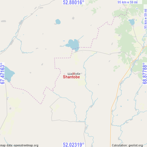
Shantobe GPS coordinates[2]
52° 27' 13.536" North, 68° 10' 29.1" East
| Map corner | latitude | longitude |
|---|---|---|
| Upper-left | 52.88016°, | 67.47163° |
| Center: | 52.45376°, | 68.17475° |
| Lower-right: | 52.02319°, | 68.87788° |
| Map W x H: | 95.3×95.3 km | = 59.2×59.2mi |
| max Lat: | 54.90596° ⇑13.7% North |
| Shantobe: | 52.45376° |
| min Lat: | ⇓86.3% South 40.66338° |
| min Long | Shantobe | max Long |
| 46.83361° | 68.17475° | 84.87144° |
| W 35.2%⇐ | ⇒64.8% E |
Elevation
Elevation of Shantobe is 385 m = 1263 ft, and this is 28.5 m = 94 ft above average elevation for this country.
| Max E: |
1847 m = 6060 ft | 40.4% |
| Shantobe | 385 m 1263 ft | |
| Avg. | 356.5 m = 1170 ft | |
Min E: |
-26 m = -85 ft | 59.6% |
See also: Kazakhstan elevation on elevation.city.
Geographical zone
Shantobe is located in North temperate zone (between Tropic of Cancer and the Arctic Circle). Distance of this North polar circle is 1568.9 km =974.9 mi to North.| Distance of | km | miles | from Shantobe |
|---|---|---|---|
| North Pole | 4174.8 | 2594.1 | to North |
| Arctic Circle | 1568.9 | 974.9 | to North |
| Tropic Cancer | 3226.4 | 2004.8 | to South |
| Equator | 5832.3 | 3624 | to South |


Nearby cities:
15 places around Shantobe: (largest is in red/bold)
• Akkol’
133.9 km =83.2 mi,  45°
45°
• Astrakhan
151.2 km =94 mi,  132°
132°
• Atbasar
73.1 km =45.4 mi,  170°
170°
• Atbasar
73.5 km =45.7 mi, 171°
• Balkashino
39.7 km =24.7 mi,  79°
79°
• Birlestik
126.3 km =78.5 mi,  5°
5°
• Esil
132.5 km =82.3 mi,  245°
245°
• Kokshetau
123.6 km =76.8 mi,  41°
41°
• Krasnogorskiy
114.7 km =71.3 mi,  258°
258°
• Makinsk
153.1 km =95.1 mi, 82°
• Novoishimskiy
125.5 km =78 mi,  311°
311°
• Shchuchinsk
145.9 km =90.7 mi,  68°
68°
• Volodarskoye
93.4 km =58 mi,  357°
357°
• Volodarskoye
109.1 km =67.8 mi,  282°
282°
• Zhaqsy
84.1 km =52.3 mi,  224°
224°
Sources, notices
• [Note1] Compared only with cities in Kazakhstan existing in our database
• [Src1] Map data: © OpenStreetMap contributors (CC-BY-SA)
• [Src2] Other city data from geonames.org with taken over terms of usage.
• [Src3] Geographical zone / Annual Mean Temperature by Robert A. Rohde @ Wikipedia
