Myrzakent geodata
Myrzakent (South Kazakhstan) is a populated place; located in Kazakhstan in Asia/Almaty (GMT+5) time zone. With population of 9,752 people, there are 120 cities with bigger population in this country. Compared to other cities in Kazakhstan, 100% of cities are located further ↑North; 61.1% of cities are located further →East and 56.3% of cities have higher elevation than Myrzakent. Note1


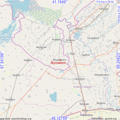
Myrzakent GPS coordinates[2]
40° 39' 48.168" North, 68° 32' 42.36" East
| Map corner | latitude | longitude |
|---|---|---|
| Upper-left | 41.1946°, | 67.84198° |
| Center: | 40.66338°, | 68.5451° |
| Lower-right: | 40.12789°, | 69.24823° |
| Map W x H: | 118.6×118.6 km | = 73.7×73.7mi |
| max Lat: | 54.90596° ⇑100% North |
| Myrzakent: | 40.66338° |
| min Lat: | ⇓0% South 40.66338° |
| min Long | Myrzakent | max Long |
| 46.83361° | 68.5451° | 84.87144° |
| W 38.9%⇐ | ⇒61.1% E |
Elevation
Elevation of Myrzakent is 269 m = 883 ft, and this is 87.5 m = 287 ft below average elevation for this country.
| Max E: |
1847 m = 6060 ft | 56.3% |
| Avg. | 356.5 m = 1170 ft | |
| Myrzakent | 269 m = 883 ft | |
Min E: |
-26 m = -85 ft | 43.7% |
See also: Kazakhstan elevation on elevation.city.
Geographical zone
Myrzakent is located in North temperate zone (between Tropic of Cancer and the Arctic Circle). Distance of this Northern Tropic circle is 1915.4 km =1190.2 mi to South.| Distance of | km | miles | from Myrzakent |
|---|---|---|---|
| North Pole | 5485.7 | 3408.7 | to North |
| Arctic Circle | 2879.8 | 1789.4 | to North |
| Tropic Cancer | 1915.4 | 1190.2 | to South |
| Equator | 4521.3 | 2809.4 | to South |


Nearby cities:
15 places around Myrzakent: (largest is in red/bold)
• Arys
197.7 km =122.8 mi,  6°
6°
• Asyqata
29.9 km =18.6 mi,  329°
329°
• Atakent
20.8 km =12.9 mi,  350°
350°
• Belyye Vody
222.7 km =138.4 mi,  28°
28°
• Chardara
81.9 km =50.9 mi,  323°
323°
• Kokterek
248.3 km =154.3 mi, 34°
• Lenger
202.5 km =125.8 mi, 33°
• Leninskoye
140.3 km =87.2 mi, 29°
• Qogham
241.7 km =150.2 mi, 354°
• Saryaghash
102.9 km =63.9 mi, 30°
• Sastobe
242.4 km =150.6 mi, 29°
• Sayram
208.4 km =129.5 mi, 28°
• Shymkent
202.1 km =125.6 mi, 25°
• Temirlanovka
223.3 km =138.8 mi,  15°
15°
• Tyul’kubas
249.5 km =155 mi,  35°
35°
Sources, notices
• [Note1] Compared only with cities in Kazakhstan existing in our database
• [Src1] Map data: © OpenStreetMap contributors (CC-BY-SA)
• [Src2] Other city data from geonames.org with taken over terms of usage.
• [Src3] Geographical zone / Annual Mean Temperature by Robert A. Rohde @ Wikipedia
