Chardara geodata
Chardara (South Kazakhstan) is a populated place; located in Kazakhstan in Asia/Almaty (GMT+5) time zone. With population of 25,356 people, there are 58 cities with bigger population in this country. Compared to other cities in Kazakhstan, 98.9% of cities are located further ↑North; 65.6% of cities are located further →East and 58.5% of cities have higher elevation than Chardara. Note1


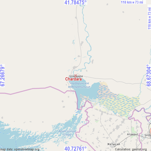
Chardara GPS coordinates[2]
41° 15' 29.952" North, 67° 58' 11.676" East
| Map corner | latitude | longitude |
|---|---|---|
| Upper-left | 41.78475°, | 67.26679° |
| Center: | 41.25832°, | 67.96991° |
| Lower-right: | 40.72761°, | 68.67304° |
| Map W x H: | 117.5×117.5 km | = 73×73mi |
| max Lat: | 54.90596° ⇑98.9% North |
| Chardara: | 41.25832° |
| min Lat: | ⇓1.1% South 40.66338° |
| min Long | Chardara | max Long |
| 46.83361° | 67.96991° | 84.87144° |
| W 34.4%⇐ | ⇒65.6% E |
Elevation
Elevation of Chardara is 255 m = 837 ft, and this is 101.5 m = 333 ft below average elevation for this country.
| Max E: |
1847 m = 6060 ft | 58.5% |
| Avg. | 356.5 m = 1170 ft | |
| Chardara | 255 m = 837 ft | |
Min E: |
-26 m = -85 ft | 41.5% |
See also: Kazakhstan elevation on elevation.city.
Geographical zone
Chardara is located in North temperate zone (between Tropic of Cancer and the Arctic Circle). Distance of this Northern Tropic circle is 1981.6 km =1231.3 mi to South.| Distance of | km | miles | from Chardara |
|---|---|---|---|
| North Pole | 5419.6 | 3367.6 | to North |
| Arctic Circle | 2813.7 | 1748.4 | to North |
| Tropic Cancer | 1981.6 | 1231.3 | to South |
| Equator | 4587.5 | 2850.5 | to South |


Nearby cities:
15 places around Chardara: (largest is in red/bold)
• Arys
147.7 km =91.8 mi,  28°
28°
• Asyqata
52.2 km =32.4 mi,  140°
140°
• Atakent
64.1 km =39.8 mi, 135°
• Belyye Vody
201 km =124.9 mi,  49°
49°
• Chayan
229.1 km =142.4 mi, 30°
• Lenger
189.3 km =117.6 mi,  57°
57°
• Leninskoye
130.1 km =80.8 mi, 64°
• Myrzakent
81.9 km =50.9 mi, 143°
• Qogham
176.4 km =109.6 mi,  8°
8°
• Saryaghash
102.5 km =63.7 mi,  77°
77°
• Sastobe
221.1 km =137.4 mi, 49°
• Sayram
188.3 km =117 mi, 51°
• Shymkent
178 km =110.6 mi, 49°
• Temirlanovka
183.3 km =113.9 mi,  35°
35°
• Turkestan
227.9 km =141.6 mi, 5°
Sources, notices
• [Note1] Compared only with cities in Kazakhstan existing in our database
• [Src1] Map data: © OpenStreetMap contributors (CC-BY-SA)
• [Src2] Other city data from geonames.org with taken over terms of usage.
• [Src3] Geographical zone / Annual Mean Temperature by Robert A. Rohde @ Wikipedia
