Atbasar geodata
Atbasar (Aqmola) is a seat of a second-order administrative division; located in Kazakhstan in Asia/Almaty (GMT+5) time zone. In our database, there are 268 cities with bigger population. Compared to other cities in Kazakhstan, 80.7% of cities are located further ↓South; 63.7% of cities are located further →East and 54.8% of cities have higher elevation than Atbasar. Note1


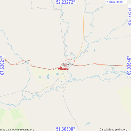
Atbasar GPS coordinates[2]
51° 48' 0" North, 68° 19' 59.988" East
| Map corner | latitude | longitude |
|---|---|---|
| Upper-left | 52.23272°, | 67.63021° |
| Center: | 51.8°, | 68.33333° |
| Lower-right: | 51.36308°, | 69.03646° |
| Map W x H: | 96.7×96.7 km | = 60.1×60.1mi |
| max Lat: | 54.90596° ⇑19.3% North |
| Atbasar: | 51.8° |
| min Lat: | ⇓80.7% South 40.66338° |
| min Long | Atbasar | max Long |
| 46.83361° | 68.33333° | 84.87144° |
| W 36.3%⇐ | ⇒63.7% E |
Elevation
Elevation of Atbasar is 280 m = 919 ft, and this is 76.5 m = 251 ft below average elevation for this country.
| Max E: |
1847 m = 6060 ft | 54.8% |
| Avg. | 356.5 m = 1170 ft | |
| Atbasar | 280 m = 919 ft | |
Min E: |
-26 m = -85 ft | 45.2% |
See also: Kazakhstan elevation on elevation.city.
Geographical zone
Atbasar is located in North temperate zone (between Tropic of Cancer and the Arctic Circle). Distance of this North polar circle is 1641.6 km =1020 mi to North.| Distance of | km | miles | from Atbasar |
|---|---|---|---|
| North Pole | 4247.4 | 2639.2 | to North |
| Arctic Circle | 1641.6 | 1020 | to North |
| Tropic Cancer | 3153.7 | 1959.6 | to South |
| Equator | 5759.6 | 3578.8 | to South |


Nearby cities:
15 places around Atbasar: (largest is in red/bold)
• Akkol
180.6 km =112.2 mi,  83°
83°
• Astrakhan
105.3 km =65.4 mi,  106°
106°
• Atbasar
2 km =1.2 mi,  68°
68°
• Balkashino
84.8 km =52.7 mi,  19°
19°
• Derzhavīnsk
160.1 km =99.5 mi,  240°
240°
• Egindiköl
114.8 km =71.3 mi,  136°
136°
• Esil
133.2 km =82.8 mi,  277°
277°
• Kokshetau
180 km =111.8 mi, 23°
• Krasnogorskiy
133.5 km =83 mi,  291°
291°
• Makinsk
169.6 km =105.4 mi,  56°
56°
• Shantobe
73.5 km =45.7 mi,  351°
351°
• Shchuchinsk
178.4 km =110.9 mi,  44°
44°
• Volodarskoye
152.2 km =94.6 mi,  308°
308°
• Volodarskoye
166.7 km =103.6 mi, 354°
• Zhaqsy
70.9 km =44.1 mi, 279°
Sources, notices
• [Note1] Compared only with cities in Kazakhstan existing in our database
• [Src1] Map data: © OpenStreetMap contributors (CC-BY-SA)
• [Src2] Other city data from geonames.org with taken over terms of usage.
• [Src3] Geographical zone / Annual Mean Temperature by Robert A. Rohde @ Wikipedia
