Sayaq geodata
Sayaq (Karaganda) is a populated place; located in Kazakhstan in Asia/Almaty (GMT+5) time zone. With population of 4,543 people, there are 202 cities with bigger population in this country. Compared to other cities in Kazakhstan, 62.2% of cities are located further ↑North; 81.5% of cities are located further ←West and 82.2% of cities have lower elevation than Sayaq. Note1


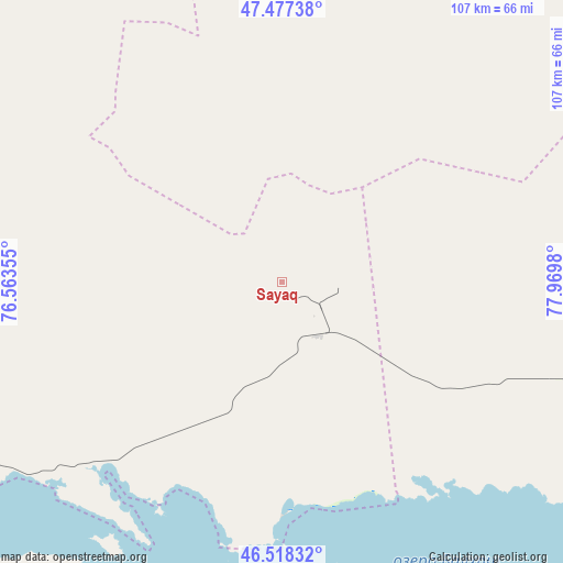
Sayaq GPS coordinates[2]
47° 0' 0" North, 77° 16' 0.012" East
| Map corner | latitude | longitude |
|---|---|---|
| Upper-left | 47.47738°, | 76.56355° |
| Center: | 47°, | 77.26667° |
| Lower-right: | 46.51832°, | 77.9698° |
| Map W x H: | 106.6×106.6 km | = 66.2×66.2mi |
| max Lat: | 54.90596° ⇑62.2% North |
| Sayaq: | 47° |
| min Lat: | ⇓37.8% South 40.66338° |
| min Long | Sayaq | max Long |
| 46.83361° | 77.26667° | 84.87144° |
| W 81.5%⇐ | ⇒18.5% E |
Elevation
Elevation of Sayaq is 593 m = 1946 ft, and this is 236.5 m = 776 ft above average elevation for this country.
| Max E: |
1847 m = 6060 ft | 17.8% |
| Sayaq | 593 m 1946 ft | |
| Avg. | 356.5 m = 1170 ft | |
Min E: |
-26 m = -85 ft | 82.2% |
See also: Kazakhstan elevation on elevation.city.
Geographical zone
Sayaq is located in North temperate zone (between Tropic of Cancer and the Arctic Circle). Distance of this North polar circle is 2175.3 km =1351.7 mi to North.| Distance of | km | miles | from Sayaq |
|---|---|---|---|
| North Pole | 4781.2 | 2970.9 | to North |
| Arctic Circle | 2175.3 | 1351.7 | to North |
| Tropic Cancer | 2620 | 1628 | to South |
| Equator | 5225.9 | 3247.2 | to South |


Nearby cities:
15 places around Sayaq: (largest is in red/bold)
• Aktogay
196.4 km =122 mi,  311°
311°
• Aqtoghay
182.2 km =113.2 mi,  91°
91°
• Ayagoz
261 km =162.2 mi,  65°
65°
• Bakanas
255.5 km =158.8 mi,  197°
197°
• Balpyk Bī
244.9 km =152.2 mi,  162°
162°
• Balqash
173.3 km =107.7 mi,  264°
264°
• Gülshat
225.3 km =140 mi, 259°
• Karabas
96.4 km =59.9 mi,  237°
237°
• Lepsy
153.9 km =95.6 mi,  123°
123°
• Matay
165.7 km =103 mi,  137°
137°
• Molaly
190 km =118.1 mi,  154°
154°
• Sarykamys
139.6 km =86.7 mi,  51°
51°
• Shashūbay
170.3 km =105.8 mi, 263°
• Taldykorgan
236.6 km =147 mi, 158°
• Ush-Tyube
202 km =125.5 mi, 164°
Sources, notices
• [Note1] Compared only with cities in Kazakhstan existing in our database
• [Src1] Map data: © OpenStreetMap contributors (CC-BY-SA)
• [Src2] Other city data from geonames.org with taken over terms of usage.
• [Src3] Geographical zone / Annual Mean Temperature by Robert A. Rohde @ Wikipedia
