Karabas geodata
Karabas is a populated place; located in Kazakhstan in Asia/Almaty (GMT+5) time zone. With population of 2,672 people, there are 234 cities with bigger population in this country. Compared to other cities in Kazakhstan, 65.6% of cities are located further ↑North; 77% of cities are located further ←West and 51.5% of cities have lower elevation than Karabas. Note1


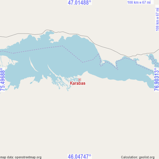
Karabas GPS coordinates[2]
46° 31' 59.988" North, 76° 12' 0" East
| Map corner | latitude | longitude |
|---|---|---|
| Upper-left | 47.01488°, | 75.49688° |
| Center: | 46.53333°, | 76.2° |
| Lower-right: | 46.04747°, | 76.90313° |
| Map W x H: | 107.6×107.6 km | = 66.9×66.9mi |
| max Lat: | 54.90596° ⇑65.6% North |
| Karabas: | 46.53333° |
| min Lat: | ⇓34.4% South 40.66338° |
| min Long | Karabas | max Long |
| 46.83361° | 76.2° | 84.87144° |
| W 77%⇐ | ⇒23% E |
Elevation
Elevation of Karabas is 340 m = 1115 ft, and this is 16.5 m = 54 ft below average elevation for this country.
| Max E: |
1847 m = 6060 ft | 48.5% |
| Avg. | 356.5 m = 1170 ft | |
| Karabas | 340 m = 1115 ft | |
Min E: |
-26 m = -85 ft | 51.5% |
See also: Kazakhstan elevation on elevation.city.
Geographical zone
Karabas is located in North temperate zone (between Tropic of Cancer and the Arctic Circle). Distance of this North polar circle is 2227.2 km =1383.9 mi to North.| Distance of | km | miles | from Karabas |
|---|---|---|---|
| North Pole | 4833 | 3003.1 | to North |
| Arctic Circle | 2227.2 | 1383.9 | to North |
| Tropic Cancer | 2568.1 | 1595.7 | to South |
| Equator | 5174 | 3215 | to South |


Nearby cities:
15 places around Karabas: (largest is in red/bold)
• Aktogay
193.8 km =120.4 mi,  339°
339°
• Aqshataū
228.8 km =142.2 mi,  315°
315°
• Bakanas
191.9 km =119.2 mi,  178°
178°
• Balqash
98.3 km =61.1 mi,  290°
290°
• Gülshat
141.3 km =87.8 mi,  274°
274°
• Lepsy
213.2 km =132.5 mi,  98°
98°
• Matay
206.3 km =128.2 mi,  110°
110°
• Molaly
202.8 km =126 mi,  126°
126°
• Moyynty
228.5 km =142 mi, 289°
• Priozersk
199.9 km =124.2 mi,  253°
253°
• Saryshaghan
203.4 km =126.4 mi,  256°
256°
• Sayaq
96.4 km =59.9 mi,  57°
57°
• Shashūbay
93.9 km =58.3 mi, 289°
• Ush-Tyube
198.2 km =123.2 mi,  135°
135°
• Ülken
226.2 km =140.6 mi,  229°
229°
Sources, notices
• [Note1] Compared only with cities in Kazakhstan existing in our database
• [Src1] Map data: © OpenStreetMap contributors (CC-BY-SA)
• [Src2] Other city data from geonames.org with taken over terms of usage.
• [Src3] Geographical zone / Annual Mean Temperature by Robert A. Rohde @ Wikipedia
