Molaly geodata
Molaly (Almaty Oblysy) is a populated place; located in Kazakhstan in Asia/Almaty (GMT+5) time zone. With population of 707 people, there are 267 cities with bigger population in this country. Compared to other cities in Kazakhstan, 69.6% of cities are located further ↑North; 84.1% of cities are located further ←West and 67.8% of cities have lower elevation than Molaly. Note1


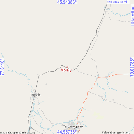
Molaly GPS coordinates[2]
45° 27' 10.008" North, 78° 18' 52.992" East
| Map corner | latitude | longitude |
|---|---|---|
| Upper-left | 45.94386°, | 77.6116° |
| Center: | 45.45278°, | 78.31472° |
| Lower-right: | 44.95738°, | 79.01785° |
| Map W x H: | 109.7×109.7 km | = 68.2×68.2mi |
| max Lat: | 54.90596° ⇑69.6% North |
| Molaly: | 45.45278° |
| min Lat: | ⇓30.4% South 40.66338° |
| min Long | Molaly | max Long |
| 46.83361° | 78.31472° | 84.87144° |
| W 84.1%⇐ | ⇒15.9% E |
Elevation
Elevation of Molaly is 445 m = 1460 ft, and this is 88.5 m = 290 ft above average elevation for this country.
| Max E: |
1847 m = 6060 ft | 32.2% |
| Molaly | 445 m 1460 ft | |
| Avg. | 356.5 m = 1170 ft | |
Min E: |
-26 m = -85 ft | 67.8% |
See also: Kazakhstan elevation on elevation.city.
Geographical zone
Molaly is located in North temperate zone (between Tropic of Cancer and the Arctic Circle). Distance of this North polar circle is 2347.3 km =1458.5 mi to North.| Distance of | km | miles | from Molaly |
|---|---|---|---|
| North Pole | 4953.2 | 3077.8 | to North |
| Arctic Circle | 2347.3 | 1458.5 | to North |
| Tropic Cancer | 2448 | 1521.1 | to South |
| Equator | 5053.9 | 3140.3 | to South |


Nearby cities:
15 places around Molaly: (largest is in red/bold)
• Aqtoghay
196.3 km =122 mi,  32°
32°
• Bakanas
175.5 km =109.1 mi,  245°
245°
• Balpyk Bī
61.6 km =38.3 mi,  186°
186°
• Kapshagay
202.2 km =125.6 mi,  209°
209°
• Karabas
202.8 km =126 mi,  306°
306°
• Lepsy
99.8 km =62 mi, 29°
• Matay
58.3 km =36.2 mi, 32°
• Sarkand
125 km =77.7 mi,  92°
92°
• Saryozek
124.3 km =77.2 mi, 192°
• Sayaq
190 km =118.1 mi,  334°
334°
• Taldykorgan
48.8 km =30.3 mi,  174°
174°
• Tekeli
79.9 km =49.6 mi,  149°
149°
• Turgen
235.3 km =146.2 mi, 194°
• Ush-Tyube
34.4 km =21.4 mi,  229°
229°
• Zharkent
195.6 km =121.5 mi,  136°
136°
Sources, notices
• [Note1] Compared only with cities in Kazakhstan existing in our database
• [Src1] Map data: © OpenStreetMap contributors (CC-BY-SA)
• [Src2] Other city data from geonames.org with taken over terms of usage.
• [Src3] Geographical zone / Annual Mean Temperature by Robert A. Rohde @ Wikipedia
