Ush-Tyube geodata
Ush-Tyube (Almaty Oblysy) is a populated place; located in Kazakhstan in Asia/Almaty (GMT+5) time zone. With population of 20,492 people, there are 65 cities with bigger population in this country. Compared to other cities in Kazakhstan, 71.5% of cities are located further ↑North; 83.3% of cities are located further ←West and 66.3% of cities have lower elevation than Ush-Tyube. Note1


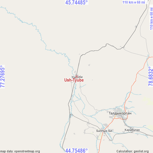
Ush-Tyube GPS coordinates[2]
45° 15' 7.236" North, 77° 58' 48.252" East
| Map corner | latitude | longitude |
|---|---|---|
| Upper-left | 45.74485°, | 77.27695° |
| Center: | 45.25201°, | 77.98007° |
| Lower-right: | 44.75486°, | 78.6832° |
| Map W x H: | 110.1×110.1 km | = 68.4×68.4mi |
| max Lat: | 54.90596° ⇑71.5% North |
| Ush-Tyube: | 45.25201° |
| min Lat: | ⇓28.5% South 40.66338° |
| min Long | Ush-Tyube | max Long |
| 46.83361° | 77.98007° | 84.87144° |
| W 83.3%⇐ | ⇒16.7% E |
Elevation
Elevation of Ush-Tyube is 430 m = 1411 ft, and this is 73.5 m = 241 ft above average elevation for this country.
| Max E: |
1847 m = 6060 ft | 33.7% |
| Ush-Tyube | 430 m 1411 ft | |
| Avg. | 356.5 m = 1170 ft | |
Min E: |
-26 m = -85 ft | 66.3% |
See also: Kazakhstan elevation on elevation.city.
Geographical zone
Ush-Tyube is located in North temperate zone (between Tropic of Cancer and the Arctic Circle). Distance of this North polar circle is 2369.6 km =1472.4 mi to North.| Distance of | km | miles | from Ush-Tyube |
|---|---|---|---|
| North Pole | 4975.5 | 3091.6 | to North |
| Arctic Circle | 2369.6 | 1472.4 | to North |
| Tropic Cancer | 2425.6 | 1507.2 | to South |
| Equator | 5031.6 | 3126.5 | to South |


Nearby cities:
15 places around Ush-Tyube: (largest is in red/bold)
• Bakanas
143 km =88.9 mi,  249°
249°
• Balpyk Bī
43.6 km =27.1 mi,  153°
153°
• Esik
215 km =133.6 mi,  191°
191°
• Kapshagay
170.3 km =105.8 mi,  205°
205°
• Karabas
198.2 km =123.2 mi,  315°
315°
• Lepsy
132.5 km =82.3 mi,  34°
34°
• Matay
91.7 km =57 mi,  38°
38°
• Molaly
34.4 km =21.4 mi,  49°
49°
• Sarkand
152.3 km =94.6 mi,  83°
83°
• Saryozek
99 km =61.5 mi,  180°
180°
• Sayaq
202 km =125.5 mi,  344°
344°
• Taldykorgan
40.6 km =25.2 mi,  130°
130°
• Tekeli
81.5 km =50.6 mi,  124°
124°
• Turgen
208.1 km =129.3 mi, 188°
• Zharkent
200.5 km =124.6 mi, 127°
Sources, notices
• [Note1] Compared only with cities in Kazakhstan existing in our database
• [Src1] Map data: © OpenStreetMap contributors (CC-BY-SA)
• [Src2] Other city data from geonames.org with taken over terms of usage.
• [Src3] Geographical zone / Annual Mean Temperature by Robert A. Rohde @ Wikipedia
