Ülken geodata
Ülken (Almaty Oblysy) is a populated place; located in Kazakhstan in Asia/Almaty (GMT+5) time zone. With population of 3,735 people, there are 218 cities with bigger population in this country. Compared to other cities in Kazakhstan, 71.9% of cities are located further ↑North; 71.1% of cities are located further ←West and 50.7% of cities have lower elevation than Ülken. Note1


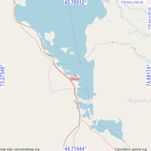
Ülken GPS coordinates[2]
45° 12' 42.984" North, 73° 58' 42.996" East
| Map corner | latitude | longitude |
|---|---|---|
| Upper-left | 45.70512°, | 73.27549° |
| Center: | 45.21194°, | 73.97861° |
| Lower-right: | 44.71444°, | 74.68174° |
| Map W x H: | 110.2×110.2 km | = 68.5×68.5mi |
| max Lat: | 54.90596° ⇑71.9% North |
| Ülken: | 45.21194° |
| min Lat: | ⇓28.1% South 40.66338° |
| min Long | Ülken | max Long |
| 46.83361° | 73.97861° | 84.87144° |
| W 71.1%⇐ | ⇒28.9% E |
Elevation
Elevation of Ülken is 339 m = 1112 ft, and this is 17.5 m = 57 ft below average elevation for this country.
| Max E: |
1847 m = 6060 ft | 49.3% |
| Avg. | 356.5 m = 1170 ft | |
| Ülken | 339 m = 1112 ft | |
Min E: |
-26 m = -85 ft | 50.7% |
See also: Kazakhstan elevation on elevation.city.
Geographical zone
Ülken is located in North temperate zone (between Tropic of Cancer and the Arctic Circle). Distance of this North polar circle is 2374.1 km =1475.2 mi to North.| Distance of | km | miles | from Ülken |
|---|---|---|---|
| North Pole | 4980 | 3094.4 | to North |
| Arctic Circle | 2374.1 | 1475.2 | to North |
| Tropic Cancer | 2421.2 | 1504.5 | to South |
| Equator | 5027.1 | 3123.7 | to South |


Nearby cities:
15 places around Ülken: (largest is in red/bold)
• Aqbaqay
96.7 km =60.1 mi,  255°
255°
• Bakanas
185.8 km =115.5 mi,  103°
103°
• Balqash
198.1 km =123.1 mi,  23°
23°
• Chu
179.7 km =111.7 mi,  185°
185°
• Georgiyevka
248.6 km =154.5 mi,  166°
166°
• Gülshat
160.3 km =99.6 mi,  10°
10°
• Karabas
226.2 km =140.6 mi,  49°
49°
• Khantaū
110.4 km =68.6 mi, 187°
• Moyynkum
131.8 km =81.9 mi,  218°
218°
• Moyynty
228.3 km =141.9 mi,  348°
348°
• Mynaral
32.3 km =20.1 mi,  314°
314°
• Oytal
262.6 km =163.2 mi, 192°
• Priozersk
93.6 km =58.2 mi, 346°
• Saryshaghan
104.7 km =65.1 mi,  344°
344°
• Shashūbay
196.4 km =122 mi, 24°
Sources, notices
• [Note1] Compared only with cities in Kazakhstan existing in our database
• [Src1] Map data: © OpenStreetMap contributors (CC-BY-SA)
• [Src2] Other city data from geonames.org with taken over terms of usage.
• [Src3] Geographical zone / Annual Mean Temperature by Robert A. Rohde @ Wikipedia
