Hoachanas geodata
Hoachanas (Hardap) is a populated place; located in Namibia in Africa/Windhoek (GMT+2) time zone. With population of 3,000 people, there are 36 cities with bigger population in this country. Compared to other cities in Namibia, 77.3% of cities are located further ↑North; 77.3% of cities are located further ←West and 72.7% of cities have lower elevation than Hoachanas. Note1


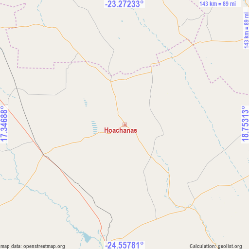
Hoachanas GPS coordinates[2]
23° 55' 0.012" South, 18° 3' 0" East
| Map corner | latitude | longitude |
|---|---|---|
| Upper-left | -23.27233°, | 17.34688° |
| Center: | -23.91667°, | 18.05° |
| Lower-right: | -24.55781°, | 18.75313° |
| Map W x H: | 142.9×142.9 km | = 88.8×88.8mi |
| max Lat: | -17.4° ⇑77.3% North |
| Hoachanas: | -23.91667° |
| min Lat: | ⇓22.7% South -28.55° |
| min Long | Hoachanas | max Long |
| 13.83998° | 18.05° | 24.26667° |
| W 77.3%⇐ | ⇒22.7% E |
Elevation
Elevation of Hoachanas is 1264 m = 4147 ft, and this is 236.2 m = 775 ft above average elevation for this country.
| Max E: |
1656 m = 5433 ft | 27.3% |
| Hoachanas | 1264 m 4147 ft | |
| Avg. | 1027.8 m = 3372 ft | |
Min E: |
1 m = 3 ft | 72.7% |
See also: Namibia elevation on elevation.city.
Geographical zone
Hoachanas is located in South temperate zone (between Tropic of Capricorn and the Antarctic Circle). Distance of this Southern Tropic circle is 53.4 km =33.2 mi to North.| Distance of | km | miles | from Hoachanas |
|---|---|---|---|
| Equator | 2659.3 | 1652.4 | to North |
| Tropic Capricorn | 53.4 | 33.2 | to North |
| Antarctic Circle | 4741.9 | 2946.5 | to South |
| South Pole | 7347.8 | 4565.7 | to South |


Nearby cities:
15 places around Hoachanas: (largest is in red/bold)
• Aranos
111 km =69 mi,  102°
102°
• Bethanie
299.4 km =186 mi,  197°
197°
• Gobabis
188.1 km =116.9 mi,  29°
29°
• Karibib
316.5 km =196.7 mi,  314°
314°
• Katutura
185 km =115 mi,  326°
326°
• Keetmanshoop
296.6 km =184.3 mi,  178°
178°
• Maltahöhe
148.5 km =92.3 mi,  226°
226°
• Mariental
80.1 km =49.8 mi,  186°
186°
• Okahandja
244.3 km =151.8 mi, 331°
• Omaruru
351.3 km =218.3 mi,  321°
321°
• Otjimbingwe
262.2 km =162.9 mi, 311°
• Rehoboth
118.4 km =73.6 mi,  304°
304°
• Tses
218.7 km =135.9 mi, 181°
• Usakos
329.1 km =204.5 mi, 310°
• Windhoek
180.4 km =112.1 mi, 326°
Sources, notices
• [Note1] Compared only with cities in Namibia existing in our database
• [Src1] Map data: © OpenStreetMap contributors (CC-BY-SA)
• [Src2] Other city data from geonames.org with taken over terms of usage.
• [Src3] Geographical zone / Annual Mean Temperature by Robert A. Rohde @ Wikipedia
