Katutura geodata
Katutura (Khomas) is a section of populated place; located in Namibia in Africa/Windhoek (GMT+2) time zone. With population of 21,243 people, there are 8 cities with bigger population in this country. Compared to other cities in Namibia, 65.9% of cities are located further ↑North; 56.8% of cities are located further ←West and 97.7% of cities have lower elevation than Katutura. Note1


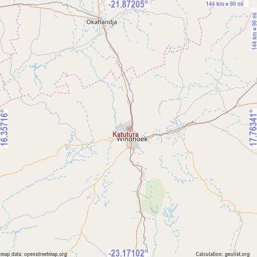
Katutura GPS coordinates[2]
22° 31' 23.016" South, 17° 3' 37.008" East
| Map corner | latitude | longitude |
|---|---|---|
| Upper-left | -21.87205°, | 16.35716° |
| Center: | -22.52306°, | 17.06028° |
| Lower-right: | -23.17102°, | 17.76341° |
| Map W x H: | 144.4×144.4 km | = 89.7×89.7mi |
| max Lat: | -17.4° ⇑65.9% North |
| Katutura: | -22.52306° |
| min Lat: | ⇓34.1% South -28.55° |
| min Long | Katutura | max Long |
| 13.83998° | 17.06028° | 24.26667° |
| W 56.8%⇐ | ⇒43.2% E |
Elevation
Elevation of Katutura is 1630 m = 5348 ft, and this is 602.2 m = 1976 ft above average elevation for this country.
| Max E: |
1656 m = 5433 ft | 2.3% |
| Katutura | 1630 m 5348 ft | |
| Avg. | 1027.8 m = 3372 ft | |
Min E: |
1 m = 3 ft | 97.7% |
See also: Namibia elevation on elevation.city.
Geographical zone
Katutura is located in South Torrid zone (between Equator and Tropic of Capricorn). Distance of this Southern Tropic circle is 101.6 km =63.1 mi to South.| Distance of | km | miles | from Katutura |
|---|---|---|---|
| Equator | 2504.3 | 1556.1 | to North |
| Tropic Capricorn | 101.6 | 63.1 | to South |
| Antarctic Circle | 4896.8 | 3042.7 | to South |
| South Pole | 7502.7 | 4662 | to South |


Nearby cities:
15 places around Katutura: (largest is in red/bold)
• Arandis
215.4 km =133.8 mi,  273°
273°
• Gobabis
196 km =121.8 mi,  87°
87°
• Hoachanas
185 km =115 mi,  146°
146°
• Karibib
142.3 km =88.4 mi,  297°
297°
• Maltahöhe
257 km =159.7 mi,  181°
181°
• Mariental
252.2 km =156.7 mi,  158°
158°
• Okahandja
61.8 km =38.4 mi,  346°
346°
• Okakarara
219.1 km =136.1 mi,  10°
10°
• Omaruru
167.9 km =104.3 mi,  316°
316°
• Otjimbingwe
97.2 km =60.4 mi,  281°
281°
• Otjiwarongo
232.9 km =144.7 mi, 349°
• Rehoboth
88.3 km =54.9 mi, 178°
• Swakopmund
260.7 km =162 mi, 266°
• Usakos
161.1 km =100.1 mi,  291°
291°
• Windhoek
4.7 km =2.9 mi, 149°
Sources, notices
• [Note1] Compared only with cities in Namibia existing in our database
• [Src1] Map data: © OpenStreetMap contributors (CC-BY-SA)
• [Src2] Other city data from geonames.org with taken over terms of usage.
• [Src3] Geographical zone / Annual Mean Temperature by Robert A. Rohde @ Wikipedia
