Rehoboth geodata
Rehoboth (Hardap) is a populated place; located in Namibia in Africa/Windhoek (GMT+2) time zone. With population of 21,377 people, there are 7 cities with bigger population in this country. Compared to other cities in Namibia, 75% of cities are located further ↑North; 61.4% of cities are located further ←West and 86.4% of cities have lower elevation than Rehoboth. Note1


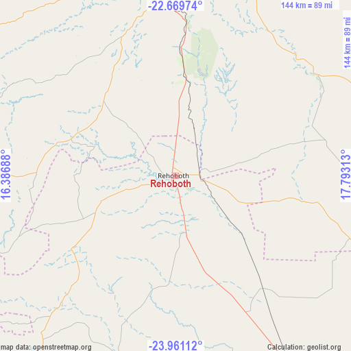
Rehoboth GPS coordinates[2]
23° 19' 1.2" South, 17° 5' 24" East
| Map corner | latitude | longitude |
|---|---|---|
| Upper-left | -22.66974°, | 16.38688° |
| Center: | -23.317°, | 17.09° |
| Lower-right: | -23.96112°, | 17.79313° |
| Map W x H: | 143.6×143.6 km | = 89.2×89.2mi |
| max Lat: | -17.4° ⇑75% North |
| Rehoboth: | -23.317° |
| min Lat: | ⇓25% South -28.55° |
| min Long | Rehoboth | max Long |
| 13.83998° | 17.09° | 24.26667° |
| W 61.4%⇐ | ⇒38.6% E |
Elevation
Elevation of Rehoboth is 1391 m = 4564 ft, and this is 363.2 m = 1192 ft above average elevation for this country.
| Max E: |
1656 m = 5433 ft | 13.6% |
| Rehoboth | 1391 m 4564 ft | |
| Avg. | 1027.8 m = 3372 ft | |
Min E: |
1 m = 3 ft | 86.4% |
See also: Namibia elevation on elevation.city.
Geographical zone
Rehoboth is located in South Torrid zone (between Equator and Tropic of Capricorn). Distance of this Southern Tropic circle is 13.3 km =8.3 mi to South.| Distance of | km | miles | from Rehoboth |
|---|---|---|---|
| Equator | 2592.6 | 1611 | to North |
| Tropic Capricorn | 13.3 | 8.3 | to South |
| Antarctic Circle | 4808.6 | 2987.9 | to South |
| South Pole | 7414.5 | 4607.2 | to South |


Nearby cities:
15 places around Rehoboth: (largest is in red/bold)
• Arandis
239.5 km =148.8 mi,  294°
294°
• Aranos
225.4 km =140.1 mi,  113°
113°
• Gobabis
215.1 km =133.7 mi,  63°
63°
• Hoachanas
118.4 km =73.6 mi,  124°
124°
• Karibib
200.8 km =124.8 mi,  320°
320°
• Katutura
88.3 km =54.9 mi,  358°
358°
• Maltahöhe
168.9 km =104.9 mi,  183°
183°
• Mariental
171.3 km =106.4 mi,  148°
148°
• Okahandja
149.4 km =92.8 mi,  353°
353°
• Omaruru
240.8 km =149.6 mi,  330°
330°
• Otjimbingwe
145.5 km =90.4 mi, 317°
• Swakopmund
271.8 km =168.9 mi, 285°
• Usakos
211.7 km =131.5 mi,  313°
313°
• Walvis Bay
267.3 km =166.1 mi,  278°
278°
• Windhoek
84.2 km =52.3 mi, 359°
Sources, notices
• [Note1] Compared only with cities in Namibia existing in our database
• [Src1] Map data: © OpenStreetMap contributors (CC-BY-SA)
• [Src2] Other city data from geonames.org with taken over terms of usage.
• [Src3] Geographical zone / Annual Mean Temperature by Robert A. Rohde @ Wikipedia
