Ondangwa geodata
Ondangwa (Oshana) is a populated place; located in Namibia in Africa/Windhoek (GMT+2) time zone. With population of 9,124 people, there are 21 cities with bigger population in this country. Compared to other cities in Namibia, 79.5% of cities are located further ↓South; 63.6% of cities are located further →East and 61.4% of cities have higher elevation than Ondangwa. Note1


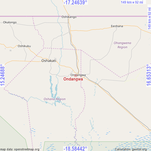
Ondangwa GPS coordinates[2]
17° 55' 0.012" South, 15° 57' 0" East
| Map corner | latitude | longitude |
|---|---|---|
| Upper-left | -17.24639°, | 15.24688° |
| Center: | -17.91667°, | 15.95° |
| Lower-right: | -18.58442°, | 16.65313° |
| Map W x H: | 148.8×148.8 km | = 92.5×92.5mi |
| max Lat: | -17.4° ⇑20.5% North |
| Ondangwa: | -17.91667° |
| min Lat: | ⇓79.5% South -28.55° |
| min Long | Ondangwa | max Long |
| 13.83998° | 15.95° | 24.26667° |
| W 36.4%⇐ | ⇒63.6% E |
Elevation
Elevation of Ondangwa is 1098 m = 3602 ft, and this is 70.2 m = 230 ft above average elevation for this country.
| Max E: |
1656 m = 5433 ft | 61.4% |
| Ondangwa | 1098 m 3602 ft | |
| Avg. | 1027.8 m = 3372 ft | |
Min E: |
1 m = 3 ft | 38.6% |
See also: Namibia elevation on elevation.city.
Geographical zone
Ondangwa is located in South Torrid zone (between Equator and Tropic of Capricorn). Distance of this Southern Tropic circle is 613.8 km =381.4 mi to South.| Distance of | km | miles | from Ondangwa |
|---|---|---|---|
| Equator | 1992.1 | 1237.8 | to North |
| Tropic Capricorn | 613.8 | 381.4 | to South |
| Antarctic Circle | 5409 | 3361 | to South |
| South Pole | 8014.9 | 4980.2 | to South |


Nearby cities:
15 places around Ondangwa: (largest is in red/bold)
• Eenhana
64.4 km =40 mi,  39°
39°
• Khorixas
291.3 km =181 mi,  200°
200°
• Nkurenkuru
282.6 km =175.6 mi,  83°
83°
• Okahao
93.5 km =58.1 mi,  271°
271°
• Omuthiya
83.3 km =51.8 mi,  126°
126°
• Ongandjera
93.5 km =58.1 mi, 272°
• Ongwediva
24.4 km =15.2 mi,  307°
307°
• Opuwo
223.7 km =139 mi, 265°
• Oshakati
29.7 km =18.5 mi,  298°
298°
• Oshikango
57.9 km =36 mi,  352°
352°
• Otavi
241.6 km =150.1 mi,  142°
142°
• Otjiwarongo
292.5 km =181.8 mi,  165°
165°
• Outapi
112.4 km =69.8 mi,  294°
294°
• Outjo
245.5 km =152.5 mi,  175°
175°
• Tsumeb
236.9 km =147.2 mi, 128°
Sources, notices
• [Note1] Compared only with cities in Namibia existing in our database
• [Src1] Map data: © OpenStreetMap contributors (CC-BY-SA)
• [Src2] Other city data from geonames.org with taken over terms of usage.
• [Src3] Geographical zone / Annual Mean Temperature by Robert A. Rohde @ Wikipedia
