Dipayal geodata
Dipayal (Far Western) is a seat of a first-order administrative division; located in Nepal in Asia/Kathmandu (GMT+5.75) time zone. With population of 23,416 people, there are 31 cities with bigger population in this country. Compared to other cities in Nepal, 91.9% of cities are located further ↓South; 94.6% of cities are located further →East and 62.2% of cities have higher elevation than Dipayal. Note1


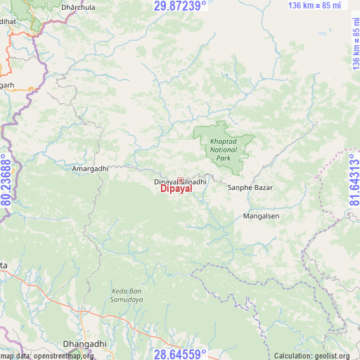
Dipayal GPS coordinates[2]
29° 15' 38.988" North, 80° 56' 24" East
| Map corner | latitude | longitude |
|---|---|---|
| Upper-left | 29.87239°, | 80.23688° |
| Center: | 29.26083°, | 80.94° |
| Lower-right: | 28.64559°, | 81.64313° |
| Map W x H: | 136.4×136.4 km | = 84.8×84.8mi |
| max Lat: | 30.04651° ⇑8.1% North |
| Dipayal: | 29.26083° |
| min Lat: | ⇓91.9% South 26.45505° |
| min Long | Dipayal | max Long |
| 80.17715° | 80.94° | 88.09436° |
| W 5.4%⇐ | ⇒94.6% E |
Elevation
Elevation of Dipayal is 565 m = 1854 ft, and this is 610.2 m = 2002 ft below average elevation for this country.
| Max E: |
5251 m = 17228 ft | 62.2% |
| Avg. | 1175.2 m = 3856 ft | |
| Dipayal | 565 m = 1854 ft | |
Min E: |
72 m = 236 ft | 37.8% |
See also: Nepal elevation on elevation.city.
Geographical zone
Dipayal is located in North temperate zone (between Tropic of Cancer and the Arctic Circle). Distance of this Northern Tropic circle is 647.6 km =402.4 mi to South.| Distance of | km | miles | from Dipayal |
|---|---|---|---|
| North Pole | 6753.6 | 4196.5 | to North |
| Arctic Circle | 4147.7 | 2577.3 | to North |
| Tropic Cancer | 647.6 | 402.4 | to South |
| Equator | 3253.5 | 2021.6 | to South |


Nearby cities:
15 places around Dipayal: (largest is in red/bold)
• Achhām
42.1 km =26.2 mi,  123°
123°
• Bardiyā
114.1 km =70.9 mi,  159°
159°
• Birendranagar
99.6 km =61.9 mi,  137°
137°
• Chhibro
114.3 km =71 mi,  49°
49°
• Dadeldhurā
35.1 km =21.8 mi,  276°
276°
• Dailekh
88 km =54.7 mi, 121°
• Dhangaḍhi̇̄
70.9 km =44.1 mi,  208°
208°
• Dārchulā
73.7 km =45.8 mi,  329°
329°
• Gulariyā
123.8 km =76.9 mi, 161°
• Jumla
120.7 km =75 mi,  89°
89°
• Khārpū
146.5 km =91 mi, 53°
• Mahendranagar
81.1 km =50.4 mi,  245°
245°
• Simikot
116.2 km =72.2 mi, 47°
• Surkhet
116.2 km =72.2 mi, 135°
• Ṭikāpur
83.3 km =51.8 mi,  167°
167°
Sources, notices
• [Note1] Compared only with cities in Nepal existing in our database
• [Src1] Map data: © OpenStreetMap contributors (CC-BY-SA)
• [Src2] Other city data from geonames.org with taken over terms of usage.
• [Src3] Geographical zone / Annual Mean Temperature by Robert A. Rohde @ Wikipedia
