Khārpū geodata
Khārpū is a populated place; located in Nepal in Asia/Kathmandu (GMT+5.75) time zone. With population of 682 people, there are 60 cities with bigger population in this country. Compared to other cities in Nepal, 100% of cities are located further ↓South; 78.4% of cities are located further →East and 100% of cities have lower elevation than Khārpū. Note1


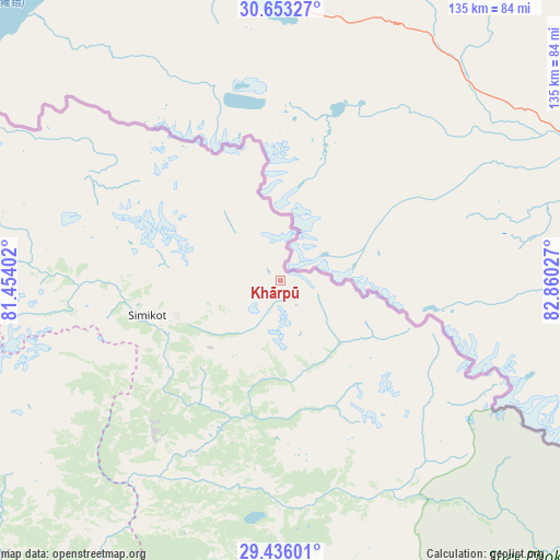
Khārpū GPS coordinates[2]
30° 2' 47.436" North, 82° 9' 25.704" East
| Map corner | latitude | longitude |
|---|---|---|
| Upper-left | 30.65327°, | 81.45402° |
| Center: | 30.04651°, | 82.15714° |
| Lower-right: | 29.43601°, | 82.86027° |
| Map W x H: | 135.3×135.3 km | = 84.1×84.1mi |
| max Lat: | 30.04651° ⇑0% North |
| Khārpū: | 30.04651° |
| min Lat: | ⇓100% South 26.45505° |
| min Long | Khārpū | max Long |
| 80.17715° | 82.15714° | 88.09436° |
| W 21.6%⇐ | ⇒78.4% E |
Elevation
Elevation of Khārpū is 5251 m = 17228 ft, and this is 4075.8 m = 13372 ft above average elevation for this country.
| Max E: |
5251 m = 17228 ft | 0% |
| Khārpū | 5251 m 17228 ft | |
| Avg. | 1175.2 m = 3856 ft | |
Min E: |
72 m = 236 ft | 100% |
See also: Nepal elevation on elevation.city.
Geographical zone
Khārpū is located in North temperate zone (between Tropic of Cancer and the Arctic Circle). Distance of this Northern Tropic circle is 734.9 km =456.6 mi to South.| Distance of | km | miles | from Khārpū |
|---|---|---|---|
| North Pole | 6666.2 | 4142.2 | to North |
| Arctic Circle | 4060.3 | 2523 | to North |
| Tropic Cancer | 734.9 | 456.6 | to South |
| Equator | 3340.9 | 2075.9 | to South |


Nearby cities:
15 places around Khārpū: (largest is in red/bold)
• Achhām
138.4 km =86 mi,  216°
216°
• Bardiyā
209.2 km =130 mi,  201°
201°
• Besisahar
203 km =126.1 mi,  172°
172°
• Birendranagar
168.4 km =104.6 mi, 197°
• Chhibro
33.3 km =20.7 mi,  246°
246°
• Dadeldhurā
173.5 km =107.8 mi,  241°
241°
• Dailekh
140.5 km =87.3 mi, 197°
• Dipayal
146.5 km =91 mi,  233°
233°
• Dārchulā
156.7 km =97.4 mi,  261°
261°
• Jomsom
207.5 km =128.9 mi,  132°
132°
• Jumla
85.9 km =53.4 mi,  178°
178°
• Salyān
185.5 km =115.3 mi, 179°
• Simikot
33 km =20.5 mi, 254°
• Surkhet
173.9 km =108.1 mi,  192°
192°
• Ṭikāpur
196.6 km =122.2 mi,  210°
210°
Sources, notices
• [Note1] Compared only with cities in Nepal existing in our database
• [Src1] Map data: © OpenStreetMap contributors (CC-BY-SA)
• [Src2] Other city data from geonames.org with taken over terms of usage.
• [Src3] Geographical zone / Annual Mean Temperature by Robert A. Rohde @ Wikipedia
