Mahendranagar geodata
Mahendranagar (Far Western) is a populated place; located in Nepal in Asia/Kathmandu (GMT+5.75) time zone. With population of 88,381 people, there are 10 cities with bigger population in this country. Compared to other cities in Nepal, 89.2% of cities are located further ↓South; 100% of cities are located further →East and 73% of cities have higher elevation than Mahendranagar. Note1


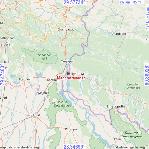
Mahendranagar GPS coordinates[2]
28° 57' 50.364" North, 80° 10' 37.74" East
| Map corner | latitude | longitude |
|---|---|---|
| Upper-left | 29.57734°, | 79.47403° |
| Center: | 28.96399°, | 80.17715° |
| Lower-right: | 28.34699°, | 80.88028° |
| Map W x H: | 136.8×136.8 km | = 85×85mi |
| max Lat: | 30.04651° ⇑10.8% North |
| Mahendranagar: | 28.96399° |
| min Lat: | ⇓89.2% South 26.45505° |
| min Long | Mahendranagar | max Long |
| 80.17715° | 80.17715° | 88.09436° |
| W 0%⇐ | ⇒100% E |
Elevation
Elevation of Mahendranagar is 199 m = 653 ft, and this is 976.2 m = 3203 ft below average elevation for this country.
| Max E: |
5251 m = 17228 ft | 73% |
| Avg. | 1175.2 m = 3856 ft | |
| Mahendranagar | 199 m = 653 ft | |
Min E: |
72 m = 236 ft | 27% |
See also: Mahendranagar elevation on elevation.city.
Geographical zone
Mahendranagar is located in North temperate zone (between Tropic of Cancer and the Arctic Circle). Distance of this Northern Tropic circle is 614.6 km =381.9 mi to South.| Distance of | km | miles | from Mahendranagar |
|---|---|---|---|
| North Pole | 6786.6 | 4217 | to North |
| Arctic Circle | 4180.7 | 2597.8 | to North |
| Tropic Cancer | 614.6 | 381.9 | to South |
| Equator | 3220.5 | 2001.1 | to South |


Nearby cities:
15 places around Mahendranagar: (largest is in red/bold)
• Achhām
109.6 km =68.1 mi,  84°
84°
• Bardiyā
136.5 km =84.8 mi,  122°
122°
• Bhojpur
193.6 km =120.3 mi,  126°
126°
• Birendranagar
147.6 km =91.7 mi,  105°
105°
• Chhibro
193.4 km =120.2 mi,  56°
56°
• Dadeldhurā
54 km =33.6 mi,  46°
46°
• Dailekh
149.8 km =93.1 mi,  95°
95°
• Dhangaḍhi̇̄
49.7 km =30.9 mi, 126°
• Dipayal
81.1 km =50.4 mi,  65°
65°
• Dārchulā
102.8 km =63.9 mi,  20°
20°
• Gulariyā
141.8 km =88.1 mi, 126°
• Nepalgunj
173.5 km =107.8 mi, 125°
• Simikot
194.7 km =121 mi, 55°
• Surkhet
163.8 km =101.8 mi, 107°
• Ṭikāpur
103.7 km =64.4 mi, 117°
Sources, notices
• [Note1] Compared only with cities in Nepal existing in our database
• [Src1] Map data: © OpenStreetMap contributors (CC-BY-SA)
• [Src2] Other city data from geonames.org with taken over terms of usage.
• [Src3] Geographical zone / Annual Mean Temperature by Robert A. Rohde @ Wikipedia
