Dārchulā geodata
Dārchulā (Western Region) is a populated place; located in Nepal in Asia/Kathmandu (GMT+5.75) time zone. With population of 18,317 people, there are 40 cities with bigger population in this country. Compared to other cities in Nepal, 95.9% of cities are located further ↓South; 98.6% of cities are located further →East and 85.1% of cities have lower elevation than Dārchulā. Note1


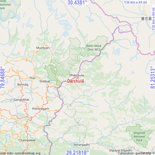
Dārchulā GPS coordinates[2]
29° 49' 48" North, 80° 33' 0" East
| Map corner | latitude | longitude |
|---|---|---|
| Upper-left | 30.4381°, | 79.84688° |
| Center: | 29.83°, | 80.55° |
| Lower-right: | 29.21818°, | 81.25313° |
| Map W x H: | 135.6×135.6 km | = 84.3×84.3mi |
| max Lat: | 30.04651° ⇑4.1% North |
| Dārchulā: | 29.83° |
| min Lat: | ⇓95.9% South 26.45505° |
| min Long | Dārchulā | max Long |
| 80.17715° | 80.55° | 88.09436° |
| W 1.4%⇐ | ⇒98.6% E |
Elevation
Elevation of Dārchulā is 1923 m = 6309 ft, and this is 747.8 m = 2453 ft above average elevation for this country.
| Max E: |
5251 m = 17228 ft | 14.9% |
| Dārchulā | 1923 m 6309 ft | |
| Avg. | 1175.2 m = 3856 ft | |
Min E: |
72 m = 236 ft | 85.1% |
See also: Nepal elevation on elevation.city.
Geographical zone
Dārchulā is located in North temperate zone (between Tropic of Cancer and the Arctic Circle). Distance of this Northern Tropic circle is 710.9 km =441.7 mi to South.| Distance of | km | miles | from Dārchulā |
|---|---|---|---|
| North Pole | 6690.3 | 4157.2 | to North |
| Arctic Circle | 4084.4 | 2537.9 | to North |
| Tropic Cancer | 710.9 | 441.7 | to South |
| Equator | 3316.8 | 2061 | to South |


Nearby cities:
15 places around Dārchulā: (largest is in red/bold)
• Achhām
113.1 km =70.3 mi,  140°
140°
• Bardiyā
187.1 km =116.3 mi,  155°
155°
• Birendranagar
172.4 km =107.1 mi, 142°
• Chhibro
124.8 km =77.5 mi,  84°
84°
• Dadeldhurā
59.2 km =36.8 mi,  177°
177°
• Dailekh
157 km =97.6 mi,  134°
134°
• Dhangaḍhi̇̄
125.6 km =78 mi, 178°
• Dipayal
73.7 km =45.8 mi,  149°
149°
• Gulariyā
196.5 km =122.1 mi, 156°
• Jumla
169.7 km =105.4 mi,  111°
111°
• Khārpū
156.7 km =97.4 mi, 81°
• Mahendranagar
102.8 km =63.9 mi,  200°
200°
• Simikot
124 km =77.1 mi, 83°
• Surkhet
188.5 km =117.1 mi, 140°
• Ṭikāpur
154.9 km =96.3 mi, 159°
Sources, notices
• [Note1] Compared only with cities in Nepal existing in our database
• [Src1] Map data: © OpenStreetMap contributors (CC-BY-SA)
• [Src2] Other city data from geonames.org with taken over terms of usage.
• [Src3] Geographical zone / Annual Mean Temperature by Robert A. Rohde @ Wikipedia
