Simikot geodata
Simikot (Mid Western) is a populated place; located in Nepal in Asia/Kathmandu (GMT+5.75) time zone. With population of 568 people, there are 61 cities with bigger population in this country. Compared to other cities in Nepal, 98.6% of cities are located further ↓South; 81.1% of cities are located further →East and 93.2% of cities have lower elevation than Simikot. Note1
Administrative division(s):
- Level 1: Mid Western
- Level 2: Karnālī Zone
- Level 3: Humlā
- Level 4: Simikot


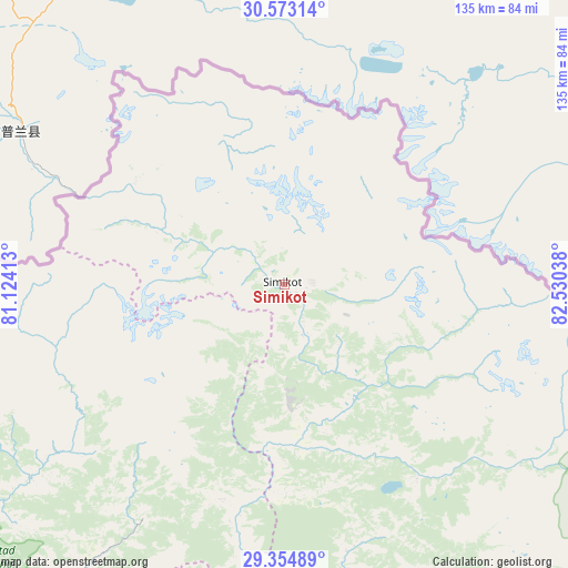
Simikot GPS coordinates[2]
29° 57' 57.168" North, 81° 49' 38.1" East
| Map corner | latitude | longitude |
|---|---|---|
| Upper-left | 30.57314°, | 81.12413° |
| Center: | 29.96588°, | 81.82725° |
| Lower-right: | 29.35489°, | 82.53038° |
| Map W x H: | 135.5×135.5 km | = 84.2×84.2mi |
| max Lat: | 30.04651° ⇑1.4% North |
| Simikot: | 29.96588° |
| min Lat: | ⇓98.6% South 26.45505° |
| min Long | Simikot | max Long |
| 80.17715° | 81.82725° | 88.09436° |
| W 18.9%⇐ | ⇒81.1% E |
Elevation
Elevation of Simikot is 2901 m = 9518 ft, and this is 1725.8 m = 5662 ft above average elevation for this country.
| Max E: |
5251 m = 17228 ft | 6.8% |
| Simikot | 2901 m 9518 ft | |
| Avg. | 1175.2 m = 3856 ft | |
Min E: |
72 m = 236 ft | 93.2% |
See also: Nepal elevation on elevation.city.
Geographical zone
Simikot is located in North temperate zone (between Tropic of Cancer and the Arctic Circle). Distance of this Northern Tropic circle is 726 km =451.1 mi to South.| Distance of | km | miles | from Simikot |
|---|---|---|---|
| North Pole | 6675.2 | 4147.8 | to North |
| Arctic Circle | 4069.3 | 2528.5 | to North |
| Tropic Cancer | 726 | 451.1 | to South |
| Equator | 3331.9 | 2070.3 | to South |


Nearby cities:
15 places around Simikot: (largest is in red/bold)
• Achhām
113.9 km =70.8 mi,  206°
206°
• Bardiyā
190.8 km =118.6 mi,  193°
193°
• Birendranagar
152.8 km =94.9 mi, 187°
• Chhibro
4.4 km =2.7 mi,  164°
164°
• Dadeldhurā
141.5 km =87.9 mi,  238°
238°
• Dailekh
125.2 km =77.8 mi, 185°
• Dhangaḍhi̇̄
184.8 km =114.8 mi,  220°
220°
• Dipayal
116.2 km =72.2 mi,  227°
227°
• Dārchulā
124 km =77.1 mi,  263°
263°
• Jumla
84.2 km =52.3 mi, 155°
• Khārpū
33 km =20.5 mi,  74°
74°
• Mahendranagar
194.7 km =121 mi, 235°
• Salyān
179.6 km =111.6 mi,  169°
169°
• Surkhet
161.1 km =100.1 mi,  181°
181°
• Ṭikāpur
174 km =108.1 mi,  203°
203°
Sources, notices
• [Note1] Compared only with cities in Nepal existing in our database
• [Src1] Map data: © OpenStreetMap contributors (CC-BY-SA)
• [Src2] Other city data from geonames.org with taken over terms of usage.
• [Src3] Geographical zone / Annual Mean Temperature by Robert A. Rohde @ Wikipedia
