Al Mindak geodata
Al Mindak (Al Bahah) is a populated place; located in Saudi Arabia in Asia/Riyadh (GMT+3) time zone. With population of 9,218 people, there are 69 cities with bigger population in this country. Compared to other cities in Saudi Arabia, 82.5% of cities are located further ↑North; 77.3% of cities are located further →East and 95.9% of cities have lower elevation than Al Mindak. Note1


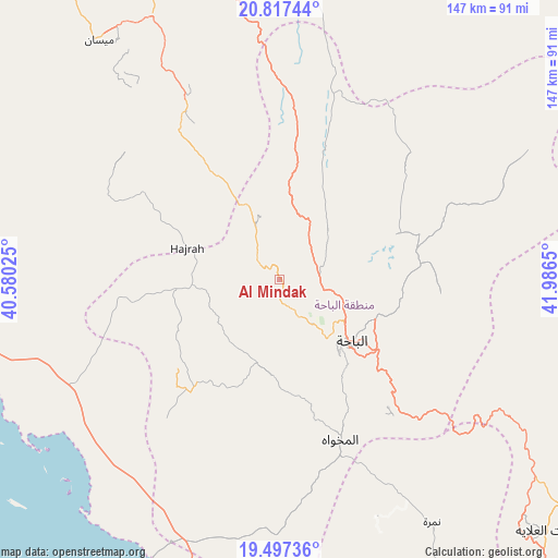
Al Mindak GPS coordinates[2]
20° 9' 31.68" North, 41° 17' 0.132" East
| Map corner | latitude | longitude |
|---|---|---|
| Upper-left | 20.81744°, | 40.58025° |
| Center: | 20.1588°, | 41.28337° |
| Lower-right: | 19.49736°, | 41.9865° |
| Map W x H: | 146.8×146.8 km | = 91.2×91.2mi |
| max Lat: | 31.67252° ⇑82.5% North |
| Al Mindak: | 20.1588° |
| min Lat: | ⇓17.5% South 16.57946° |
| min Long | Al Mindak | max Long |
| 35.69014° | 41.28337° | 54.09599° |
| W 22.7%⇐ | ⇒77.3% E |
Elevation
Elevation of Al Mindak is 2006 m = 6581 ft, and this is 1484.6 m = 4871 ft above average elevation for this country.
| Max E: |
2385 m = 7825 ft | 4.1% |
| Al Mindak | 2006 m 6581 ft | |
| Avg. | 521.4 m = 1711 ft | |
Min E: |
3 m = 10 ft | 95.9% |
See also: Saudi Arabia elevation on elevation.city.
Geographical zone
Al Mindak is located in North Torrid zone (between Equator and Tropic of Cancer). Distance of this Northern Tropic circle is 364.5 km =226.5 mi to North.| Distance of | km | miles | from Al Mindak |
|---|---|---|---|
| North Pole | 7765.6 | 4825.3 | to North |
| Arctic Circle | 5159.7 | 3206.1 | to North |
| Tropic Cancer | 364.5 | 226.5 | to North |
| Equator | 2241.4 | 1392.7 | to South |


Nearby cities:
15 places around Al Mindak: (largest is in red/bold)
• Abha
251.2 km =156.1 mi,  149°
149°
• Al Bahah
25.2 km =15.7 mi,  130°
130°
• Al Hadā
169.7 km =105.4 mi,  322°
322°
• Al Jumūm
231.1 km =143.6 mi,  314°
314°
• Al Majāridah
132.6 km =82.4 mi, 150°
• Al Muwayh
257.6 km =160.1 mi,  11°
11°
• An Nimāş
142.7 km =88.7 mi,  142°
142°
• Ash Shafā
143.3 km =89 mi, 315°
• Jeddah
265.7 km =165.1 mi, 305°
• Khamis Mushait
256.7 km =159.5 mi, 143°
• Mecca
207 km =128.6 mi, 312°
• Qal‘at Bīshah
139.2 km =86.5 mi,  97°
97°
• Tabālah
118.9 km =73.9 mi, 101°
• Ta’if
153 km =95.1 mi, 323°
• Turabah
122.8 km =76.3 mi,  17°
17°
Sources, notices
• [Note1] Compared only with cities in Saudi Arabia existing in our database
• [Src1] Map data: © OpenStreetMap contributors (CC-BY-SA)
• [Src2] Other city data from geonames.org with taken over terms of usage.
• [Src3] Geographical zone / Annual Mean Temperature by Robert A. Rohde @ Wikipedia
