Ranérou geodata
Ranérou (Matam) is a populated place; located in Senegal in Africa/Dakar (GMT+0) time zone. With population of 1,426 people, there are 56 cities with bigger population in this country. Compared to other cities in Senegal, 80% of cities are located further ↓South; 85% of cities are located further ←West and 76.7% of cities have lower elevation than Ranérou. Note1


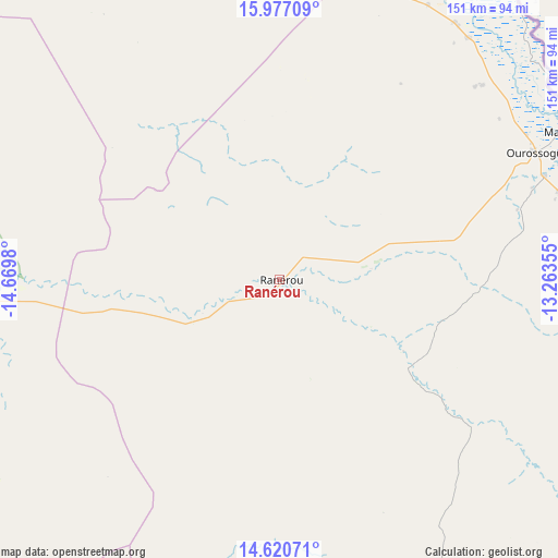
Ranérou GPS coordinates[2]
15° 18' 0" North, 13° 58' 0.012" West
| Map corner | latitude | longitude |
|---|---|---|
| Upper-left | 15.97709°, | -14.6698° |
| Center: | 15.3°, | -13.96667° |
| Lower-right: | 14.62071°, | -13.26355° |
| Map W x H: | 150.8×150.8 km | = 93.7×93.7mi |
| max Lat: | 16.51293° ⇑20% North |
| Ranérou: | 15.3° |
| min Lat: | ⇓80% South 12.485° |
| min Long | Ranérou | max Long |
| -17.47581° | -13.96667° | -12.18076° |
| W 85%⇐ | ⇒15% E |
Elevation
Elevation of Ranérou is 33 m = 108 ft, and this is 8.5 m = 28 ft above average elevation for this country.
| Max E: |
127 m = 417 ft | 23.3% |
| Ranérou | 33 m 108 ft | |
| Avg. | 24.5 m = 80 ft | |
Min E: |
0 m = 0 ft | 76.7% |
See also: Senegal elevation on elevation.city.
Geographical zone
Ranérou is located in North Torrid zone (between Equator and Tropic of Cancer). Distance of this Northern Tropic circle is 904.7 km =562.2 mi to North.| Distance of | km | miles | from Ranérou |
|---|---|---|---|
| North Pole | 8305.9 | 5161 | to North |
| Arctic Circle | 5700 | 3541.8 | to North |
| Tropic Cancer | 904.7 | 562.2 | to North |
| Equator | 1701.2 | 1057.1 | to South |


Nearby cities:
15 places around Ranérou: (largest is in red/bold)
• Dara
162.4 km =100.9 mi,  271°
271°
• Diawara
155.8 km =96.8 mi,  101°
101°
• Goléré
107.2 km =66.6 mi,  352°
352°
• Kaffrine
216 km =134.2 mi,  232°
232°
• Kanel
87.4 km =54.3 mi,  75°
75°
• Koungheul
171.7 km =106.7 mi,  211°
211°
• Matam
85.9 km =53.4 mi,  62°
62°
• Ndibène Dahra
162 km =100.7 mi, 271°
• Ndioum
153.2 km =95.2 mi,  331°
331°
• Ouro Sogui
77 km =47.8 mi, 63°
• Polel Diaoubé
103.7 km =64.4 mi,  92°
92°
• Sémé
110.2 km =68.5 mi, 96°
• Tambacounda
173.1 km =107.6 mi,  169°
169°
• Touba
211.8 km =131.6 mi,  256°
256°
• Waoundé
117.9 km =73.3 mi, 91°
Sources, notices
• [Note1] Compared only with cities in Senegal existing in our database
• [Src1] Map data: © OpenStreetMap contributors (CC-BY-SA)
• [Src2] Other city data from geonames.org with taken over terms of usage.
• [Src3] Geographical zone / Annual Mean Temperature by Robert A. Rohde @ Wikipedia
