Waoundé geodata
Waoundé (Matam) is a populated place; located in Senegal in Africa/Dakar (GMT+0) time zone. With population of 9,085 people, there are 43 cities with bigger population in this country. Compared to other cities in Senegal, 76.7% of cities are located further ↓South; 96.7% of cities are located further ←West and 65% of cities have lower elevation than Waoundé. Note1


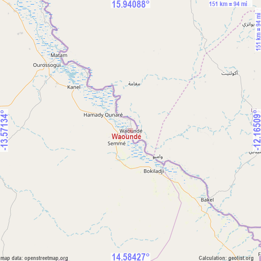
Waoundé GPS coordinates[2]
15° 15' 49.212" North, 12° 52' 5.556" West
| Map corner | latitude | longitude |
|---|---|---|
| Upper-left | 15.94088°, | -13.57134° |
| Center: | 15.26367°, | -12.86821° |
| Lower-right: | 14.58427°, | -12.16509° |
| Map W x H: | 150.8×150.8 km | = 93.7×93.7mi |
| max Lat: | 16.51293° ⇑23.3% North |
| Waoundé: | 15.26367° |
| min Lat: | ⇓76.7% South 12.485° |
| min Long | Waoundé | max Long |
| -17.47581° | -12.86821° | -12.18076° |
| W 96.7%⇐ | ⇒3.3% E |
Elevation
Elevation of Waoundé is 24 m = 79 ft, and this is 0.5 m = 2 ft below average elevation for this country.
| Max E: |
127 m = 417 ft | 35% |
| Avg. | 24.5 m = 80 ft | |
| Waoundé | 24 m = 79 ft | |
Min E: |
0 m = 0 ft | 65% |
See also: Senegal elevation on elevation.city.
Geographical zone
Waoundé is located in North Torrid zone (between Equator and Tropic of Cancer). Distance of this Northern Tropic circle is 908.8 km =564.7 mi to North.| Distance of | km | miles | from Waoundé |
|---|---|---|---|
| North Pole | 8309.9 | 5163.5 | to North |
| Arctic Circle | 5704 | 3544.3 | to North |
| Tropic Cancer | 908.8 | 564.7 | to North |
| Equator | 1697.2 | 1054.6 | to South |


Nearby cities:
15 places around Waoundé: (largest is in red/bold)
• Dara
280.3 km =174.2 mi,  271°
271°
• Diawara
44 km =27.3 mi,  127°
127°
• Goléré
172 km =106.9 mi,  309°
309°
• Kanel
41.6 km =25.8 mi, 307°
• Koungheul
251.9 km =156.5 mi,  235°
235°
• Kédougou
310.1 km =192.7 mi,  166°
166°
• Matam
60.2 km =37.4 mi,  316°
316°
• Ndibène Dahra
279.9 km =173.9 mi, 271°
• Ndioum
235.5 km =146.3 mi, 306°
• Ouro Sogui
61.8 km =38.4 mi, 308°
• Polel Diaoubé
14.1 km =8.8 mi, 271°
• Ranérou
117.9 km =73.3 mi, 271°
• Sémé
11.3 km =7 mi,  226°
226°
• Tambacounda
187 km =116.2 mi,  207°
207°
• Vélingara
270.8 km =168.3 mi, 209°
Sources, notices
• [Note1] Compared only with cities in Senegal existing in our database
• [Src1] Map data: © OpenStreetMap contributors (CC-BY-SA)
• [Src2] Other city data from geonames.org with taken over terms of usage.
• [Src3] Geographical zone / Annual Mean Temperature by Robert A. Rohde @ Wikipedia
