Nchelenge geodata
Nchelenge (Luapula) is a populated place; located in Zambia in Africa/Lusaka (GMT+2) time zone. With population of 23,693 people, there are 21 cities with bigger population in this country. Compared to other cities in Zambia, 93.9% of cities are located further ↓South; 63.6% of cities are located further ←West and 89.4% of cities have higher elevation than Nchelenge. Note1


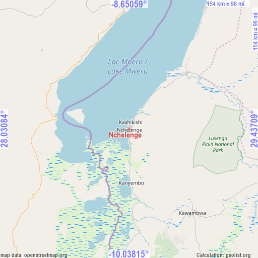
Nchelenge GPS coordinates[2]
9° 20' 42.216" South, 28° 44' 2.256" East
| Map corner | latitude | longitude |
|---|---|---|
| Upper-left | -8.65059°, | 28.03084° |
| Center: | -9.34506°, | 28.73396° |
| Lower-right: | -10.03815°, | 29.43709° |
| Map W x H: | 154.3×154.3 km | = 95.9×95.9mi |
| max Lat: | -8.46887° ⇑6.1% North |
| Nchelenge: | -9.34506° |
| min Lat: | ⇓93.9% South -17.84194° |
| min Long | Nchelenge | max Long |
| 22.67926° | 28.73396° | 33.1782° |
| W 63.6%⇐ | ⇒36.4% E |
Elevation
Elevation of Nchelenge is 933 m = 3061 ft, and this is 210.4 m = 690 ft below average elevation for this country.
| Max E: |
1622 m = 5322 ft | 89.4% |
| Avg. | 1143.4 m = 3751 ft | |
| Nchelenge | 933 m = 3061 ft | |
Min E: |
328 m = 1076 ft | 10.6% |
See also: Zambia elevation on elevation.city.
Geographical zone
Nchelenge is located in South Torrid zone (between Equator and Tropic of Capricorn). Distance of Equator is 1039.1 km =645.7 mi to North.| Distance of | km | miles | from Nchelenge |
|---|---|---|---|
| Equator | 1039.1 | 645.7 | to North |
| Tropic Capricorn | 1566.8 | 973.6 | to South |
| Antarctic Circle | 6362.1 | 3953.2 | to South |
| South Pole | 8968 | 5572.5 | to South |


Nearby cities:
15 places around Nchelenge: (largest is in red/bold)
• Chililabombwe
350.2 km =217.6 mi,  196°
196°
• Chingola
366 km =227.4 mi,  194°
194°
• Kaputa
141 km =87.6 mi,  46°
46°
• Kasama
284.9 km =177 mi,  109°
109°
• Kataba
304.6 km =189.3 mi,  157°
157°
• Kawambwa
62.4 km =38.8 mi,  142°
142°
• Luwingu
165.8 km =103 mi,  127°
127°
• Mansa
207 km =128.6 mi,  175°
175°
• Mbala
294.4 km =182.9 mi,  79°
79°
• Mporokoso
152.6 km =94.8 mi,  91°
91°
• Mpulungu
269.3 km =167.3 mi, 76°
• Mufulira
360.4 km =223.9 mi, 188°
• Mungwi
303.1 km =188.3 mi, 107°
• Mwense
115.6 km =71.8 mi, 181°
• Samfya
241.9 km =150.3 mi, 158°
Sources, notices
• [Note1] Compared only with cities in Zambia existing in our database
• [Src1] Map data: © OpenStreetMap contributors (CC-BY-SA)
• [Src2] Other city data from geonames.org with taken over terms of usage.
• [Src3] Geographical zone / Annual Mean Temperature by Robert A. Rohde @ Wikipedia
