Kawambwa geodata
Kawambwa (Luapula) is a populated place; located in Zambia in Africa/Lusaka (GMT+2) time zone. With population of 20,589 people, there are 22 cities with bigger population in this country. Compared to other cities in Zambia, 90.9% of cities are located further ↓South; 66.7% of cities are located further ←West and 81.8% of cities have lower elevation than Kawambwa. Note1


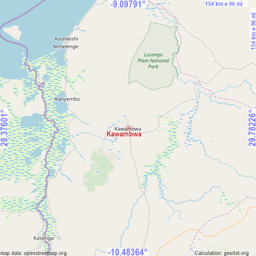
Kawambwa GPS coordinates[2]
9° 47' 29.4" South, 29° 4' 44.868" East
| Map corner | latitude | longitude |
|---|---|---|
| Upper-left | -9.09791°, | 28.37601° |
| Center: | -9.7915°, | 29.07913° |
| Lower-right: | -10.48364°, | 29.78226° |
| Map W x H: | 154.1×154.1 km | = 95.8×95.8mi |
| max Lat: | -8.46887° ⇑9.1% North |
| Kawambwa: | -9.7915° |
| min Lat: | ⇓90.9% South -17.84194° |
| min Long | Kawambwa | max Long |
| 22.67926° | 29.07913° | 33.1782° |
| W 66.7%⇐ | ⇒33.3% E |
Elevation
Elevation of Kawambwa is 1342 m = 4403 ft, and this is 198.6 m = 652 ft above average elevation for this country.
| Max E: |
1622 m = 5322 ft | 18.2% |
| Kawambwa | 1342 m 4403 ft | |
| Avg. | 1143.4 m = 3751 ft | |
Min E: |
328 m = 1076 ft | 81.8% |
See also: Zambia elevation on elevation.city.
Geographical zone
Kawambwa is located in South Torrid zone (between Equator and Tropic of Capricorn). Distance of Equator is 1088.7 km =676.5 mi to North.| Distance of | km | miles | from Kawambwa |
|---|---|---|---|
| Equator | 1088.7 | 676.5 | to North |
| Tropic Capricorn | 1517.2 | 942.7 | to South |
| Antarctic Circle | 6312.5 | 3922.4 | to South |
| South Pole | 8918.3 | 5541.6 | to South |


Nearby cities:
15 places around Kawambwa: (largest is in red/bold)
• Chililabombwe
317.3 km =197.2 mi,  205°
205°
• Chingola
331.1 km =205.7 mi,  203°
203°
• Kaputa
160.4 km =99.7 mi,  23°
23°
• Kasama
234.9 km =146 mi,  101°
101°
• Kataba
245 km =152.2 mi,  161°
161°
• Luwingu
106.6 km =66.2 mi,  119°
119°
• Mansa
157.9 km =98.1 mi,  187°
187°
• Mbala
272.3 km =169.2 mi,  67°
67°
• Mporokoso
123.8 km =76.9 mi, 67°
• Mpulungu
250.9 km =155.9 mi,  62°
62°
• Mufulira
320 km =198.8 mi, 196°
• Mungwi
254.4 km =158.1 mi, 99°
• Mwense
78 km =48.5 mi, 212°
• Nchelenge
62.4 km =38.8 mi,  322°
322°
• Samfya
182.6 km =113.5 mi, 163°
Sources, notices
• [Note1] Compared only with cities in Zambia existing in our database
• [Src1] Map data: © OpenStreetMap contributors (CC-BY-SA)
• [Src2] Other city data from geonames.org with taken over terms of usage.
• [Src3] Geographical zone / Annual Mean Temperature by Robert A. Rohde @ Wikipedia
