Kataba geodata
Kataba (Copperbelt) is a populated place; located in Zambia in Africa/Lusaka (GMT+2) time zone. With population of 14,000 people, there are 31 cities with bigger population in this country. Compared to other cities in Zambia, 72.7% of cities are located further ↓South; 72.7% of cities are located further ←West and 51.5% of cities have higher elevation than Kataba. Note1


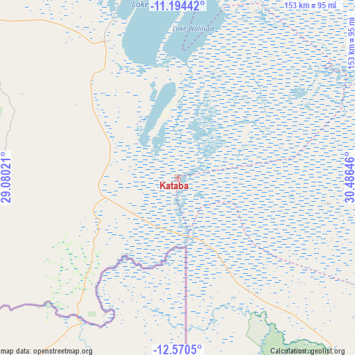
Kataba GPS coordinates[2]
11° 52' 59.988" South, 29° 46' 59.988" East
| Map corner | latitude | longitude |
|---|---|---|
| Upper-left | -11.19442°, | 29.08021° |
| Center: | -11.88333°, | 29.78333° |
| Lower-right: | -12.5705°, | 30.48646° |
| Map W x H: | 153×153 km | = 95.1×95.1mi |
| max Lat: | -8.46887° ⇑27.3% North |
| Kataba: | -11.88333° |
| min Lat: | ⇓72.7% South -17.84194° |
| min Long | Kataba | max Long |
| 22.67926° | 29.78333° | 33.1782° |
| W 72.7%⇐ | ⇒27.3% E |
Elevation
Elevation of Kataba is 1163 m = 3816 ft, and this is 19.6 m = 64 ft above average elevation for this country.
| Max E: |
1622 m = 5322 ft | 51.5% |
| Kataba | 1163 m 3816 ft | |
| Avg. | 1143.4 m = 3751 ft | |
Min E: |
328 m = 1076 ft | 48.5% |
See also: Zambia elevation on elevation.city.
Geographical zone
Kataba is located in South Torrid zone (between Equator and Tropic of Capricorn). Distance of this Southern Tropic circle is 1284.6 km =798.2 mi to South.| Distance of | km | miles | from Kataba |
|---|---|---|---|
| Equator | 1321.3 | 821 | to North |
| Tropic Capricorn | 1284.6 | 798.2 | to South |
| Antarctic Circle | 6079.9 | 3777.9 | to South |
| South Pole | 8685.8 | 5397.1 | to South |


Nearby cities:
15 places around Kataba: (largest is in red/bold)
• Chambishi
205.6 km =127.8 mi,  246°
246°
• Chililabombwe
219.7 km =136.5 mi,  255°
255°
• Chingola
218.6 km =135.8 mi, 250°
• Kalulushi
212.1 km =131.8 mi,  239°
239°
• Kitwe
198.8 km =123.5 mi, 239°
• Luanshya
203.5 km =126.4 mi,  226°
226°
• Luwingu
180.9 km =112.4 mi,  4°
4°
• Mansa
123.1 km =76.5 mi,  308°
308°
• Mkushi
197.7 km =122.8 mi,  192°
192°
• Mpika
181.8 km =113 mi,  88°
88°
• Mufulira
183.3 km =113.9 mi, 246°
• Mwense
204.4 km =127 mi,  324°
324°
• Ndola
172.6 km =107.2 mi, 226°
• Samfya
62.7 km =39 mi,  336°
336°
• Serenje
157.8 km =98.1 mi,  161°
161°
Sources, notices
• [Note1] Compared only with cities in Zambia existing in our database
• [Src1] Map data: © OpenStreetMap contributors (CC-BY-SA)
• [Src2] Other city data from geonames.org with taken over terms of usage.
• [Src3] Geographical zone / Annual Mean Temperature by Robert A. Rohde @ Wikipedia
