Luwingu geodata
Luwingu (Northern) is a populated place; located in Zambia in Africa/Lusaka (GMT+2) time zone. With population of 6,161 people, there are 51 cities with bigger population in this country. Compared to other cities in Zambia, 84.8% of cities are located further ↓South; 74.2% of cities are located further ←West and 86.4% of cities have lower elevation than Luwingu. Note1


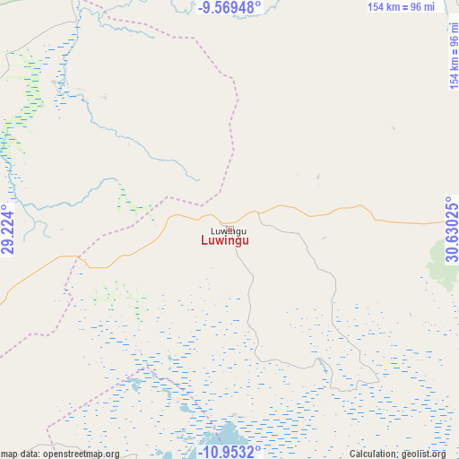
Luwingu GPS coordinates[2]
10° 15' 43.56" South, 29° 55' 37.632" East
| Map corner | latitude | longitude |
|---|---|---|
| Upper-left | -9.56948°, | 29.224° |
| Center: | -10.2621°, | 29.92712° |
| Lower-right: | -10.9532°, | 30.63025° |
| Map W x H: | 153.9×153.9 km | = 95.6×95.6mi |
| max Lat: | -8.46887° ⇑15.2% North |
| Luwingu: | -10.2621° |
| min Lat: | ⇓84.8% South -17.84194° |
| min Long | Luwingu | max Long |
| 22.67926° | 29.92712° | 33.1782° |
| W 74.2%⇐ | ⇒25.8% E |
Elevation
Elevation of Luwingu is 1381 m = 4531 ft, and this is 237.6 m = 780 ft above average elevation for this country.
| Max E: |
1622 m = 5322 ft | 13.6% |
| Luwingu | 1381 m 4531 ft | |
| Avg. | 1143.4 m = 3751 ft | |
Min E: |
328 m = 1076 ft | 86.4% |
See also: Zambia elevation on elevation.city.
Geographical zone
Luwingu is located in South Torrid zone (between Equator and Tropic of Capricorn). Distance of Equator is 1141 km =709 mi to North.| Distance of | km | miles | from Luwingu |
|---|---|---|---|
| Equator | 1141 | 709 | to North |
| Tropic Capricorn | 1464.9 | 910.2 | to South |
| Antarctic Circle | 6260.1 | 3889.8 | to South |
| South Pole | 8866 | 5509.1 | to South |


Nearby cities:
15 places around Luwingu: (largest is in red/bold)
• Chinsali
237.7 km =147.7 mi,  97°
97°
• Isoka
296.4 km =184.2 mi,  87°
87°
• Kaputa
201.5 km =125.2 mi,  351°
351°
• Kasama
137.3 km =85.3 mi, 87°
• Kataba
180.9 km =112.4 mi,  184°
184°
• Kawambwa
106.6 km =66.2 mi,  299°
299°
• Mansa
153.6 km =95.4 mi,  227°
227°
• Mbala
223.3 km =138.8 mi,  44°
44°
• Mpika
241.4 km =150 mi,  136°
136°
• Mporokoso
101.2 km =62.9 mi,  12°
12°
• Mpulungu
211.5 km =131.4 mi, 37°
• Mungwi
158.1 km =98.2 mi, 86°
• Mwense
135.1 km =83.9 mi,  264°
264°
• Nchelenge
165.8 km =103 mi,  307°
307°
• Samfya
129.1 km =80.2 mi,  198°
198°
Sources, notices
• [Note1] Compared only with cities in Zambia existing in our database
• [Src1] Map data: © OpenStreetMap contributors (CC-BY-SA)
• [Src2] Other city data from geonames.org with taken over terms of usage.
• [Src3] Geographical zone / Annual Mean Temperature by Robert A. Rohde @ Wikipedia
