Mansa geodata
Mansa (Luapula) is a seat of a first-order administrative division; located in Zambia in Africa/Lusaka (GMT+2) time zone. With population of 42,277 people, there are 16 cities with bigger population in this country. Compared to other cities in Zambia, 80.3% of cities are located further ↓South; 65.2% of cities are located further ←West and 57.6% of cities have lower elevation than Mansa. Note1


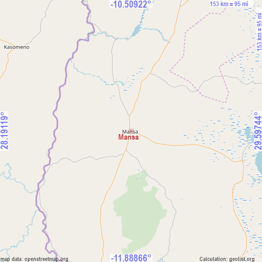
Mansa GPS coordinates[2]
11° 11' 59.136" South, 28° 53' 39.516" East
| Map corner | latitude | longitude |
|---|---|---|
| Upper-left | -10.50922°, | 28.19119° |
| Center: | -11.19976°, | 28.89431° |
| Lower-right: | -11.88866°, | 29.59744° |
| Map W x H: | 153.4×153.4 km | = 95.3×95.3mi |
| max Lat: | -8.46887° ⇑19.7% North |
| Mansa: | -11.19976° |
| min Lat: | ⇓80.3% South -17.84194° |
| min Long | Mansa | max Long |
| 22.67926° | 28.89431° | 33.1782° |
| W 65.2%⇐ | ⇒34.8% E |
Elevation
Elevation of Mansa is 1216 m = 3990 ft, and this is 72.6 m = 238 ft above average elevation for this country.
| Max E: |
1622 m = 5322 ft | 42.4% |
| Mansa | 1216 m 3990 ft | |
| Avg. | 1143.4 m = 3751 ft | |
Min E: |
328 m = 1076 ft | 57.6% |
See also: Mansa elevation on elevation.city.
Geographical zone
Mansa is located in South Torrid zone (between Equator and Tropic of Capricorn). Distance of Equator is 1245.3 km =773.8 mi to North.| Distance of | km | miles | from Mansa |
|---|---|---|---|
| Equator | 1245.3 | 773.8 | to North |
| Tropic Capricorn | 1360.6 | 845.4 | to South |
| Antarctic Circle | 6155.9 | 3825.1 | to South |
| South Pole | 8761.8 | 5444.3 | to South |


Nearby cities:
15 places around Mansa: (largest is in red/bold)
• Chambishi
183.7 km =114.1 mi,  209°
209°
• Chililabombwe
174.3 km =108.3 mi,  221°
221°
• Chingola
184.2 km =114.5 mi, 216°
• Kalulushi
202.2 km =125.6 mi, 205°
• Kataba
123.1 km =76.5 mi,  128°
128°
• Kawambwa
157.9 km =98.1 mi,  7°
7°
• Kitwe
193 km =119.9 mi,  202°
202°
• Luanshya
221.5 km =137.6 mi,  193°
193°
• Luwingu
153.6 km =95.4 mi,  47°
47°
• Mporokoso
243.7 km =151.4 mi,  33°
33°
• Mufulira
166.1 km =103.2 mi, 205°
• Mwense
93.2 km =57.9 mi,  346°
346°
• Nchelenge
207 km =128.6 mi,  355°
355°
• Ndola
197.6 km =122.8 mi, 188°
• Samfya
74.5 km =46.3 mi,  104°
104°
Sources, notices
• [Note1] Compared only with cities in Zambia existing in our database
• [Src1] Map data: © OpenStreetMap contributors (CC-BY-SA)
• [Src2] Other city data from geonames.org with taken over terms of usage.
• [Src3] Geographical zone / Annual Mean Temperature by Robert A. Rohde @ Wikipedia
