Chililabombwe geodata
Chililabombwe (Copperbelt) is a populated place; located in Zambia in Africa/Lusaka (GMT+2) time zone. With population of 57,328 people, there are 12 cities with bigger population in this country. Compared to other cities in Zambia, 66.7% of cities are located further ↓South; 62.1% of cities are located further →East and 77.3% of cities have lower elevation than Chililabombwe. Note1


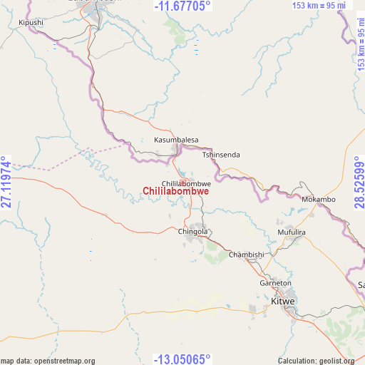
Chililabombwe GPS coordinates[2]
12° 21' 53.1" South, 27° 49' 22.296" East
| Map corner | latitude | longitude |
|---|---|---|
| Upper-left | -11.67705°, | 27.11974° |
| Center: | -12.36475°, | 27.82286° |
| Lower-right: | -13.05065°, | 28.52599° |
| Map W x H: | 152.7×152.7 km | = 94.9×94.9mi |
| max Lat: | -8.46887° ⇑33.3% North |
| Chililabombwe: | -12.36475° |
| min Lat: | ⇓66.7% South -17.84194° |
| min Long | Chililabombwe | max Long |
| 22.67926° | 27.82286° | 33.1782° |
| W 37.9%⇐ | ⇒62.1% E |
Elevation
Elevation of Chililabombwe is 1316 m = 4318 ft, and this is 172.6 m = 566 ft above average elevation for this country.
| Max E: |
1622 m = 5322 ft | 22.7% |
| Chililabombwe | 1316 m 4318 ft | |
| Avg. | 1143.4 m = 3751 ft | |
Min E: |
328 m = 1076 ft | 77.3% |
See also: Chililabombwe elevation on elevation.city.
Geographical zone
Chililabombwe is located in South Torrid zone (between Equator and Tropic of Capricorn). Distance of this Southern Tropic circle is 1231.1 km =765 mi to South.| Distance of | km | miles | from Chililabombwe |
|---|---|---|---|
| Equator | 1374.8 | 854.3 | to North |
| Tropic Capricorn | 1231.1 | 765 | to South |
| Antarctic Circle | 6026.3 | 3744.6 | to South |
| South Pole | 8632.2 | 5363.8 | to South |


Nearby cities:
15 places around Chililabombwe: (largest is in red/bold)
• Chambishi
38.9 km =24.2 mi,  139°
139°
• Chingola
19.4 km =12.1 mi,  160°
160°
• Kalulushi
60.7 km =37.7 mi,  150°
150°
• Kansanshi
154.6 km =96.1 mi,  281°
281°
• Kapiri Mposhi
200.8 km =124.8 mi, 152°
• Kataba
219.7 km =136.5 mi,  75°
75°
• Kitwe
64.5 km =40.1 mi, 138°
• Luanshya
107.3 km =66.7 mi, 143°
• Mansa
174.3 km =108.3 mi,  41°
41°
• Mkushi
220.1 km =136.8 mi,  129°
129°
• Mpongwe
132.2 km =82.1 mi, 164°
• Mufulira
49.8 km =30.9 mi,  114°
114°
• Ndola
110.2 km =68.5 mi, 126°
• Samfya
219 km =136.1 mi,  59°
59°
• Solwezi
157.3 km =97.7 mi, 277°
Sources, notices
• [Note1] Compared only with cities in Zambia existing in our database
• [Src1] Map data: © OpenStreetMap contributors (CC-BY-SA)
• [Src2] Other city data from geonames.org with taken over terms of usage.
• [Src3] Geographical zone / Annual Mean Temperature by Robert A. Rohde @ Wikipedia
