Mungwi geodata
Mungwi (Northern) is a populated place; located in Zambia in Africa/Lusaka (GMT+2) time zone. With population of 6,821 people, there are 49 cities with bigger population in this country. Compared to other cities in Zambia, 87.9% of cities are located further ↓South; 87.9% of cities are located further ←West and 89.4% of cities have lower elevation than Mungwi. Note1


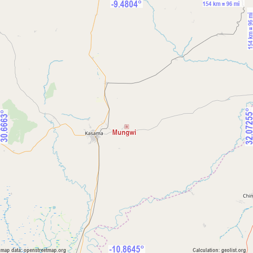
Mungwi GPS coordinates[2]
10° 10' 23.52" South, 31° 22' 9.912" East
| Map corner | latitude | longitude |
|---|---|---|
| Upper-left | -9.4804°, | 30.6663° |
| Center: | -10.1732°, | 31.36942° |
| Lower-right: | -10.8645°, | 32.07255° |
| Map W x H: | 153.9×153.9 km | = 95.6×95.6mi |
| max Lat: | -8.46887° ⇑12.1% North |
| Mungwi: | -10.1732° |
| min Lat: | ⇓87.9% South -17.84194° |
| min Long | Mungwi | max Long |
| 22.67926° | 31.36942° | 33.1782° |
| W 87.9%⇐ | ⇒12.1% E |
Elevation
Elevation of Mungwi is 1382 m = 4534 ft, and this is 238.6 m = 783 ft above average elevation for this country.
| Max E: |
1622 m = 5322 ft | 10.6% |
| Mungwi | 1382 m 4534 ft | |
| Avg. | 1143.4 m = 3751 ft | |
Min E: |
328 m = 1076 ft | 89.4% |
See also: Zambia elevation on elevation.city.
Geographical zone
Mungwi is located in South Torrid zone (between Equator and Tropic of Capricorn). Distance of Equator is 1131.2 km =702.9 mi to North.| Distance of | km | miles | from Mungwi |
|---|---|---|---|
| Equator | 1131.2 | 702.9 | to North |
| Tropic Capricorn | 1474.8 | 916.4 | to South |
| Antarctic Circle | 6270 | 3896 | to South |
| South Pole | 8875.9 | 5515.2 | to South |


Nearby cities:
15 places around Mungwi: (largest is in red/bold)
• Chama
226.5 km =140.7 mi,  120°
120°
• Chinsali
88 km =54.7 mi, 117°
• Isoka
138.4 km =86 mi,  89°
89°
• Kaputa
266.5 km =165.6 mi,  315°
315°
• Kasama
21.1 km =13.1 mi,  257°
257°
• Kataba
257.1 km =159.8 mi,  222°
222°
• Kawambwa
254.4 km =158.1 mi,  279°
279°
• Luwingu
158.1 km =98.2 mi,  266°
266°
• Mbala
148.2 km =92.1 mi,  359°
359°
• Mpika
184.9 km =114.9 mi,  177°
177°
• Mporokoso
162.8 km =101.2 mi,  303°
303°
• Mpulungu
159.4 km =99 mi,  349°
349°
• Mwense
293.2 km =182.2 mi, 265°
• Nakonde
176.8 km =109.9 mi,  58°
58°
• Samfya
238.3 km =148.1 mi,  236°
236°
Sources, notices
• [Note1] Compared only with cities in Zambia existing in our database
• [Src1] Map data: © OpenStreetMap contributors (CC-BY-SA)
• [Src2] Other city data from geonames.org with taken over terms of usage.
• [Src3] Geographical zone / Annual Mean Temperature by Robert A. Rohde @ Wikipedia
