Chingola geodata
Chingola (Copperbelt) is a seat of a second-order administrative division; located in Zambia in Africa/Lusaka (GMT+2) time zone. With population of 148,564 people, there are 4 cities with bigger population in this country. Compared to other cities in Zambia, 65.2% of cities are located further ↓South; 60.6% of cities are located further →East and 83.3% of cities have lower elevation than Chingola. Note1


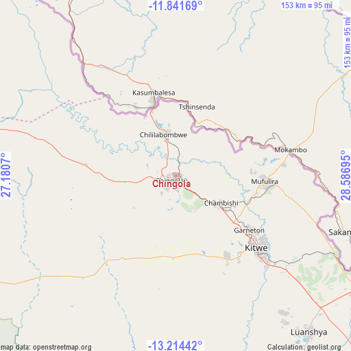
Chingola GPS coordinates[2]
12° 31' 44.292" South, 27° 53' 1.752" East
| Map corner | latitude | longitude |
|---|---|---|
| Upper-left | -11.84169°, | 27.1807° |
| Center: | -12.52897°, | 27.88382° |
| Lower-right: | -13.21442°, | 28.58695° |
| Map W x H: | 152.6×152.6 km | = 94.8×94.8mi |
| max Lat: | -8.46887° ⇑34.8% North |
| Chingola: | -12.52897° |
| min Lat: | ⇓65.2% South -17.84194° |
| min Long | Chingola | max Long |
| 22.67926° | 27.88382° | 33.1782° |
| W 39.4%⇐ | ⇒60.6% E |
Elevation
Elevation of Chingola is 1363 m = 4472 ft, and this is 219.6 m = 720 ft above average elevation for this country.
| Max E: |
1622 m = 5322 ft | 16.7% |
| Chingola | 1363 m 4472 ft | |
| Avg. | 1143.4 m = 3751 ft | |
Min E: |
328 m = 1076 ft | 83.3% |
See also: Chingola elevation on elevation.city.
Geographical zone
Chingola is located in South Torrid zone (between Equator and Tropic of Capricorn). Distance of this Southern Tropic circle is 1212.8 km =753.6 mi to South.| Distance of | km | miles | from Chingola |
|---|---|---|---|
| Equator | 1393.1 | 865.6 | to North |
| Tropic Capricorn | 1212.8 | 753.6 | to South |
| Antarctic Circle | 6008.1 | 3733.3 | to South |
| South Pole | 8614 | 5352.5 | to South |


Nearby cities:
15 places around Chingola: (largest is in red/bold)
• Chambishi
21.7 km =13.5 mi,  121°
121°
• Chililabombwe
19.4 km =12.1 mi,  340°
340°
• Kabwe
221.8 km =137.8 mi,  164°
164°
• Kalulushi
41.6 km =25.8 mi,  146°
146°
• Kansanshi
165.4 km =102.8 mi,  286°
286°
• Kapiri Mposhi
181.6 km =112.8 mi, 152°
• Kataba
218.6 km =135.8 mi,  70°
70°
• Kitwe
46.9 km =29.1 mi,  130°
130°
• Luanshya
88.9 km =55.2 mi,  139°
139°
• Mansa
184.2 km =114.5 mi,  36°
36°
• Mkushi
203.6 km =126.5 mi, 126°
• Mpongwe
112.9 km =70.2 mi, 164°
• Mufulira
38.8 km =24.1 mi,  93°
93°
• Ndola
94.6 km =58.8 mi, 120°
• Solwezi
167.2 km =103.9 mi,  283°
283°
Sources, notices
• [Note1] Compared only with cities in Zambia existing in our database
• [Src1] Map data: © OpenStreetMap contributors (CC-BY-SA)
• [Src2] Other city data from geonames.org with taken over terms of usage.
• [Src3] Geographical zone / Annual Mean Temperature by Robert A. Rohde @ Wikipedia
